Security News
Research
Data Theft Repackaged: A Case Study in Malicious Wrapper Packages on npm
The Socket Research Team breaks down a malicious wrapper package that uses obfuscation to harvest credentials and exfiltrate sensitive data.
Fast geo Rust helper functions for Python.
To get the great circle distance between two points in meters, this function will use the IUGG mean Earth radius.
distance_in_meters = georgio.great_circle_distance(lon1, lat1, lon2, lat2)
If you want to provide your own radius in meters, you can use this function instead.
distance_in_meters = georgio.great_circle_distance_with_radius(lon1, lat1, lon2, lat2, radius_in_meters)
Returns the destination coordinates based on a starting position, bearing, and distance in meters. Bearing is in degrees, clockwise from north. It uses the IUGG mean Earth radius.
dest_lon, dest_lat = georgio.line_of_bearing(start_lon, start_lat, bearing_in_degrees, distance_in_meters)
If you want to provide your own radius in meters, you can use this function instead.
dest_lon, dest_lat = georgio.line_of_bearing_with_radius(start_lon, start_lat, bearing_in_degrees, distance_in_meters, radius_in_meters)
This function will return a bounding box that encompasses the specified distance around a center point. Note that the bounding box will never extend across the antimeridian (longitude +/-180), below latitude -90, or above latitude 90.
west, south, east, north = georgio.bounding_box_for_point(lon, lat, distance_in_meters)
To get the longitude/latitude bounds of a Web Mercator tile, use the following function, which will return the values in west, south, east, north order.
west, south, east, north = georgio.wm_bounds(x, y, z)
To get the upper left corner of a tile in longitude, latitude order, use the following function.
longitude, latitude = georgio.wm_upper_left(x, y, z)
To get a bounding box that surrounds a tile at a certain distance, use the following function. This can be useful when searching for centerpoints of objects that might be outside of the tile, where the object might extend into the tile. Note that the bounding box size is calculated in the WGS-84 projection based on the tile's longitude/latitude bounds, since Web Mercator is notoriously bad for calculating sizes/distances. Also note that the bounding box will never extend across the antimeridian (longitude +/-180), below latitude -90, or above latitude 90.
west, south, east, north = georgio.wm_tile_expanded_bbox(x, y, z, search_distance_in_meters)
FAQs
Fast Geo Rust functions for Python
We found that georgio demonstrated a healthy version release cadence and project activity because the last version was released less than a year ago. It has 1 open source maintainer collaborating on the project.
Did you know?

Socket for GitHub automatically highlights issues in each pull request and monitors the health of all your open source dependencies. Discover the contents of your packages and block harmful activity before you install or update your dependencies.

Security News
Research
The Socket Research Team breaks down a malicious wrapper package that uses obfuscation to harvest credentials and exfiltrate sensitive data.

Research
Security News
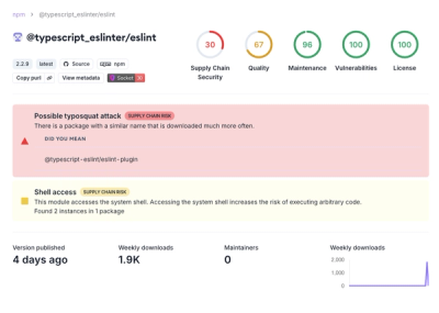
Attackers used a malicious npm package typosquatting a popular ESLint plugin to steal sensitive data, execute commands, and exploit developer systems.

Security News
The Ultralytics' PyPI Package was compromised four times in one weekend through GitHub Actions cache poisoning and failure to rotate previously compromised API tokens.