Security News
/Research
Wallet-Draining npm Package Impersonates Nodemailer to Hijack Crypto Transactions
Malicious npm package impersonates Nodemailer and drains wallets by hijacking crypto transactions across multiple blockchains.
open-street-map-reverse-geo-node-client
Advanced tools
[](https://travis-ci.com/damienmarchandfr/open-street-map-reverse-geo-node-client)
A free reverse geocoding service.
This library can be used to get location information from latitude and longitude for free. To get faster results, it is possible to enable the cache feature to store request results. This allows to reduce the number of API calls. It uses the OSM fundation API: https://wiki.osmfoundation.org/wiki/Main_Page
Open Street Map Reverse GeoCoding is a free service. Use it with moderation.
To install Open Street Map Reverse GeoCoding, run the following command:
yarn add open-street-map-reverse-geo-node-client
or
npm install open-street-map-reverse-geo-node-client --save
This library does not use callbacks. Use promises instead.
( see src/tests/index.test.ts file )
import { ReverseGeocoder } from  '.';

const  geo  =  new  ReverseGeocoder()
const result = await geo.getReverse('0','0')
The response:
{
    placeId:  '91511633',
    displayName:  'Opéra Municipal, Place de Jaude, Bonnabaud, Clermont-Ferrand, Puy-de-Dôme Auvergne-Rhône - Alpes, France métropolitaine, 63037, France',
    lat:  '45.77755365',
    lng:  '3.08255435728528',
    address:
    {
	    theatre:  'Opéra Municipal',
	    pedestrian:  'Place de Jaude',
	    suburb:  'Bonnabaud',
	    city:  'Clermont-Ferrand',
	    county:  'Clermont-Ferrand',
	    state:  'Auvergne-Rhône-Alpes',
	    country:  'France',
	    postcode:  '63037',
	    countryCode:  'fr'
    },
    fromCache :  false
}
const Geo = require('./dist')

const reverse = new Geo.ReverseGeocoder()

reverse.getReverse('45.777210', '3.082520')
	.then((location)=>{console.log(location)})
	.catch(err=>{console.error(err)})
Cache is enabled by default. To disable this option:
geo.disableCache()
You can configure your reverse geocoder instance.
const fakeGeo = new ReverseGeocoder({
	cacheIsEnabled : false, // Enable or disable cache
	callApi : false, // Set to true for your tests
	maxCacheSize : 200 // Number of elements saved in memory
})
If you want to run your test without calling API you can configure your reverse geocoder instance.
const fakeGeo = new ReverseGeocoder({
	cacheIsEnabled : false,
	callApi : false
})
yarn run test
or
npm run test
FAQs
[](https://travis-ci.com/damienmarchandfr/open-street-map-reverse-geo-node-client)
The npm package open-street-map-reverse-geo-node-client receives a total of 0 weekly downloads. As such, open-street-map-reverse-geo-node-client popularity was classified as not popular.
We found that open-street-map-reverse-geo-node-client demonstrated a not healthy version release cadence and project activity because the last version was released a year ago. It has 1 open source maintainer collaborating on the project.
Did you know?

Socket for GitHub automatically highlights issues in each pull request and monitors the health of all your open source dependencies. Discover the contents of your packages and block harmful activity before you install or update your dependencies.

Security News
/Research
Malicious npm package impersonates Nodemailer and drains wallets by hijacking crypto transactions across multiple blockchains.

Security News
This episode explores the hard problem of reachability analysis, from static analysis limits to handling dynamic languages and massive dependency trees.

Security News
/Research
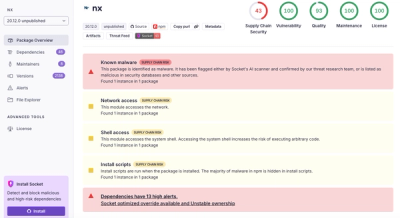
Malicious Nx npm versions stole secrets and wallet info using AI CLI tools; Socket’s AI scanner detected the supply chain attack and flagged the malware.