React-ArcGIS


React-ArcGIS is a library of React components which use the ArcGIS API for JavaScript. React-ArcGIS uses esri-loader internally to load and interact with the AMD ArcGIS API for JavaScript, and provide a base for building mapping applications.
Installation:
- Run
npm i react-arcgis (if you decide you like it, you can even include --save)
Version 3.3.3
- React-arcgis will now load version 4.9 of the ArcGIS JS API by default
- Fixed issue with the
zoom prop on Scene components
Version 3.3.2
- React-arcgis components now accept a
childrenAsFunction prop:
    render() {
        return (
            <Scene
                className="scene__container"
                childrenAsFunction={(map: __esri.Map, view: __esri.SceneView) => (
                    <BermudaTriangle map={map} view={view} />
                )}
            />
        );
    }
This is helpful for TypeScript users, as it allows the compiler to understand the relationship between parent and child components. If you are not using TypeScript, there is no benefit to using this prop over specifying children in the usual manner.
Version 3.3.1
- React-arcgis will now load version 4.8 by default
- Issue with using
mapProperties in the WebMap and WebScene components has been fixed
Version 3.3.0
- React-arcgis will now load version 4.7 by default
loadModules from https://github.com/Esri/esri-loader can now also be imported as loadModules instead of just esriPromise for consistency. For example:
import { loadModules, esriPromise } from 'react-arcgis';
loadModules === esriPromise
Version 3.2.0:
- You can now include loader options directly in react-arcgis components. This provides an easy way to migrate to esri's newer async/await compatible promises in your react-arcgis application. For example:
render() {
    return (
        <Map
            loaderOptions={{
                dojoConfig: {
                    has: {
                    "esri-promise-compatibility": 1
                    }
                }
            }}
        />
    );
}
Basic Usage:
Don't forget to load the js api stylesheet! https://js.arcgis.com/4.8/esri/css/main.css
If you need to support browsers lacking a native promise implementation, you will have to add a global Promise constructor polyfill to your project, as react-arcgis does not include one. I recommend es6-promise.
Render a simple map in React:
import * as React from 'react';
import * as ReactDOM from 'react-dom';
import { Map } from 'react-arcgis';

ReactDOM.render(
  <Map />,
  document.getElementById('container')
);
Or, render a 3D web-scene:
import * as ReactDOM from 'react-dom';
import { Scene } from 'react-arcgis';

ReactDOM.render(
  <Scene />,
  document.getElementById('container')
);
You can also add webmaps and webscenes from ArcGIS Online:
import * as React from 'react';
import * as ReactDOM from 'react-dom';
import { WebMap, WebScene } from 'react-arcgis';

ReactDOM.render(
    <div style={{ width: '100vw', height: '100vh' }}>
        <WebMap id="6627e1dd5f594160ac60f9dfc411673f" />
        <WebScene id="f8aa0c25485a40a1ada1e4b600522681" />
    </div>,
  document.getElementById('container')
);
If you want to change the style of the Map or Scene, just give it a class:
import * as React from 'react';
import * as ReactDOM from 'react-dom';
import { Scene } from 'react-arcgis';

ReactDOM.render(
  <Scene className="full-screen-map" />,
  document.getElementById('container')
);
You can also pass properties into the Map, MapView, or SceneView via the viewProperties or mapProperties props:
import * as React from 'react';
import { Map } from 'react-arcgis';

export default (props) => (
    <Map
        class="full-screen-map"
        mapProperties={{ basemap: 'satellite' }}
    />
)
These properties are passed directly to the available properties on the corresponding ArcGIS API classes:
import * as React from 'react';
import { Scene } from 'react-arcgis';

export default (props) => (
    <Scene
        style={{ width: '100vw', height: '100vh' }}
        mapProperties={{ basemap: 'satellite' }}
        viewProperties={{
            center: [-122.4443, 47.2529],
            zoom: 6
        }}
    />
)
If you want to access the map and view instances directly after they are loaded, pass in an onLoad handler:
import * as React from 'react';
import { Map } from 'react-arcgis';

export default class MakeAMap extends React.Component {
    constructor(props) {
        super(props);
        this.state = {
            map: null,
            view: null
        };

        this.handleMapLoad = this.handleMapLoad.bind(this)
    }

    render() {
        return <Map className="full-screen-map" onLoad={this.handleMapLoad} />;
    }

    handleMapLoad(map, view) {
        this.setState({ map, view });
    }
}
Don't forget an onFail handler in case something goes wrong:
import * as React from 'react';
import { WebScene } from 'react-arcgis';

export default class MakeAScene extends React.Component {
    constructor(props) {
        super(props);
        this.state = {
            status: 'loading'
        };

        this.handleFail = this.handleFail.bind(this);
    }

    render() {
        return <WebScene className="full-screen-map" id="foobar" onFail={this.handleFail} />;
    }

    handleFail(e) {
        console.error(e);
        this.setState({ status: 'failed' });
    }
}
"Advanced" Usage:
The functionality available through the ArcGIS API for JavaScript goes well beyond just rendering maps, and if your application needs to do more with the map than simply show it, you will quickly find that you need access to the rest of Esri's API.
React-arcgis provides the children of <Map />, <Scene />, <WebMap />, and <WebScene /> with access to their parent's map and view instances through props. Combined with loadModules, we can use this to easily get other functionality from the ArcGIS JS API and use it within our react application.
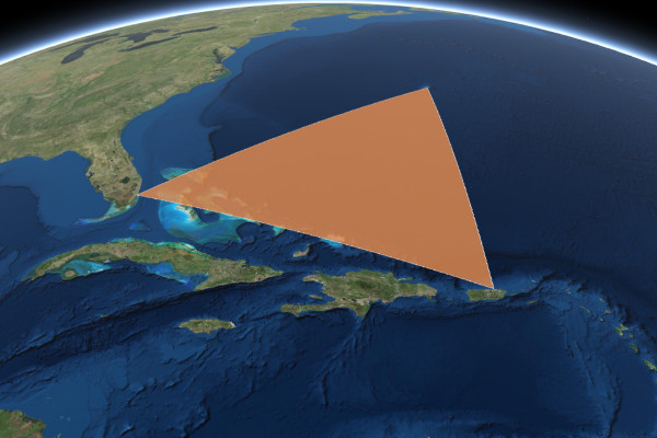
For example, let's convert a Bermuda Triangle graphic from this example into a react component:
import * as React from 'react';
import { loadModules } from 'react-arcgis';
export default class BermudaTriangle extends React.Component {
constructor(props) {
super(props);
this.state = {
graphic: null
};
}
render() {
return null;
}
componentWillMount() {
loadModules(['esri/Graphic']).then(([ Graphic ]) => {
const polygon = {
type: "polygon",
rings: [
[-64.78, 32.3],
[-66.07, 18.45],
[-80.21, 25.78],
[-64.78, 32.3]
]
};
const fillSymbol = {
type: "simple-fill",
color: [227, 139, 79, 0.8],
outline: {
color: [255, 255, 255],
width: 1
}
};
const graphic = new Graphic({
geometry: polygon,
symbol: fillSymbol
});
this.setState({ graphic });
this.props.view.graphics.add(graphic);
})).catch((err) => console.error(err));
}
componentWillUnmount() {
this.props.view.graphics.remove(this.state.graphic);
}
}
Now we can use the <BermudaTriangle /> component within our <Map />, <Scene />, <WebMap />, or <WebScene />, and the map and view props will automatically be supplied by react-arcgis:
import * as React from 'react';
import { Scene } from 'react-arcgis';
import BermudaTriangle from './BermudaTriangle';
export default (props) => (
<Scene class="full-screen-map">
<BermudaTriangle />
</Scene>
)
Contributions
Anyone is welcome to contribute to this package. My only "rule" is that your contribution must either pass the existing unit tests, or include additional unit tests to cover new functionality.
Here are some commands that may be helpful for development:
npm test: Runs the unit testsnpm run build: Builds the application
License
MIT