

Research
Two Malicious Rust Crates Impersonate Popular Logger to Steal Wallet Keys
Socket uncovers malicious Rust crates impersonating fast_log to steal Solana and Ethereum wallet keys from source code.
By Kirill Boychenko - Sep 24, 2025
supercluster-googlemaps-adapter
Advanced tools
Supercluster Adapter for Google Maps JavaScript API v3


The Supercluster adapter for Google Maps JavaScript API v3 brings functionality of the supercluster a very fast geospatial point clustering library to Google Maps.
The library accepts a standard GeoJSON FeatureCollection. The feature collection might contain any geometry features. All features with a Point geometry will be clusterized with a supercluster while all non-Point features will be added to the Google Maps Data Layer. The library provides several callbacks that allow customize point or cluster markers as well as data layer features appearence and behavior.
The Supercluster adapter library can be served from the firebase host. Add the following script tag in your html file.
<script src="https://maps-tools-242a6.firebaseapp.com/clusterer/supercluster/index.js">
</script>
It can also be installed from npm
npm install supercluster-googlemaps-adapter --save
Add library to your javascript or typescript file as
import { SuperClusterAdapterLoader } from 'supercluster-googlemaps-adapter';
Please note that this library depends on the Google Maps JavaScript API, so it should be initialized once the Google Maps JavaScript API is fully loaded.
Typically Google Maps JavaScript API is loaded in asynchronous way as specified in the official documentation
<script async defer
src="https://maps.googleapis.com/maps/api/js?key=[YOUR_API_KEY]]&callback=initMap">
</script>
That means we must include clusterer initialization code inside initMap() callback function after map object initialization.
E.g.
function initMap() {
  var map = new google.maps.Map(document.getElementById('map'), {
    zoom: 5,
    center:  {lat: 41.3850639, lng: 2.1734035}
  });

  google.maps.event.addListenerOnce(map, 'tilesloaded', () => {
    SuperClusterAdapterLoader.getClusterer().then(Clusterer => {
      if (Clusterer) {
        const clusterer = new Clusterer.Builder(map)
          .withRadius(80)
          .withMaxZoom(19)
          .withMinZoom(0)
          .build();

        fetch(URL_TO_GET_GEOJSON_DATA).then(response => {
          return response.json();
        }).then(data => {
          clusterer.load(data);
        }).catch(err => {
          console.log("Cannot fetch GeoJSON data for this example");
        });
      }
    });
  });
}
In this example the clusterer iniatialization was carried out as a response to tilesloaded event of map instance. This event is triggered when all tiles of Google Maps are loaded and map is ready to be used.
Note that clusterer is loaded asynchronously, so the logic should be implemented once SuperClusterAdapterLoader.getClusterer() promise is resolved.
In order to set up a clusterer you should call SuperClusterAdapterLoader.getClusterer() method that returns a promise. Once resolved the promise you will have a Clusterer class that should be used to create an instance of clusterer object.
Code snippet is the following
SuperClusterAdapterLoader.getClusterer().then(Clusterer => {
  if (Clusterer) {
    // TODO: create instance of clusterer
  }
});
In order to create instance of clusterer you must call Builder, the Builder accepts an instance of google.maps.Map as a constructor parameter and allows call several chained functions to establish parameters of clusterer.
const clusterer = new Clusterer.Builder(map)
    .withRadius(80)
    .withMaxZoom(19)
    .withMinZoom(0)
    .build();
The Builder class supports a set of public methods that allow customize the clusterer.
Defines cluster radius, in pixels. Default value is 80.
Maximum zoom level at which clusters are generated. Default: 19.
Minimum zoom level at which clusters are generated. Default: 0.
Defines styles for clusters such as images, fonts or text colors.
Note: the 0-index array element is used to define default style. The clusterer will use elements with indexes from 1 to 5. There is the following meaning of the indexes:
This interface is used to style the cluster's icons. There is default implementation of styles, but you can override it applying array of styles in Builder object
interface IStyle {
    url: string;                // Url of icon to use
    height: number;             // Height of icon
    width: number;              // Width of icon
    textColor?: string;         // Text color of cluster label
    fontFamily?: string;        // Font family of cluster label
    textSize?: number;          // Text size of cluster label
    fontWeight?: string;        // Font weight of cluster label
    anchor?: number[] | null;   // Anchor of cluster icon
}
Specifies the URL path where the cluster images are located.
Specifies extension of cluster images
Specifies if map should zoom in after clicking the cluster icon. Default: true.
You can specify a callback function that will be used to set a custom icon on individual markers that are not clusterized. This function receives a GeoJSON Feature with a Point geometry, it should return the URL that represents a marker icon or Symbol object of Google Maps JavaScript API.
E.g.
function customMarkerIcon(feature) {
  if (feature.properties.iconUrl) {
    return feature.properties.iconUrl;
  } else {
    return "http://maps.google.com/mapfiles/kml/paddle/pink-blank.png";
  }
}

const clusterer = new Clusterer.Builder(map)
    .withCustomMarkerIcon(customMarkerIcon)
    .build();
You can define a callback function that will be used to set a custom icon for an individual cluster. This function has priority over static cluster images that you can define using a styles array. This function receives a GeoJSON cluster Feature with a Point geometry and corresponding cluster properties and clusterIndex value that describes how many items the cluster contains. It should return an Icon object or Symbol object of Google Maps JavaScript API. Alternatively, you can return null value that means you will fallback to the default cluster icon defined in styles.
The clusterIndex supports the following values
E.g.
function customClusterIcon(feature, index) {
  let color;
  let scale;
  switch (index) {
    case 1:
      color = YELLOW;
      scale = SCALE.small;
      break;
    case 2:
      color = GREEN;
      scale = SCALE.medium;
      break;
    case 3:
      color = BLUE;
      scale = SCALE.big;
      break;
    case 4:
      color = RED;
      scale = SCALE.huge;
      break;
    default:
      color = GREY;
      scale = SCALE.small;
      break;
  }
  return {
    path: CLUSTER_PATH,
    fillColor: color.fillColor,
    fillOpacity: 1,
    strokeColor: color.strokeColor,
    strokeOpacity: 1,
    strokeWeight: 13,
    scale: scale,
    anchor: new google.maps.Point(70, 70),
    labelOrigin: new google.maps.Point(74, 74)
  };
}

const clusterer = new Clusterer.Builder(map)
    .withCustomClusterIcon(customClusterIcon)
    .build();
Sometimes you need update certain properties of existing markers, for example change icon color or zIndex. This callback function is used to update marker options. This function receives a GeoJSON Feature of cluster or marker with a Point geometry and corresponding properties and a Marker object of Google Maps JavaScript API. It should return a Marker options object that will be applied to existing marker. Alternatively, you can return null value in order to avoid marker options update.
E.g.
function updateMarkerOptions(feature, marker) {
  function randomColor() {
    var arr = [GREEN, RED, BLUE, YELLOW, BROWN, GREY];
    var rand = Math.floor(Math.random()*(arr.length-1));
    return arr[rand];
  }

  var color = randomColor();
  var markerIcon = marker.getIcon();

  if (feature.properties.cluster === true) {
    markerIcon.fillColor = color.fillColor;
    markerIcon.strokeColor = color.strokeColor;
  } else {
    markerIcon.fillColor = color.fillColor;
  }
  return {
    icon: markerIcon
  };
}

const clusterer = new Clusterer.Builder(map)
    .withUpdateMarkerOptions(updateMarkerOptions)
    .build();
You can define a callback function to respond the click events on individual markers that are not clustered. This function receives two parameters. The first is the Google Maps Marker and the second is Google Maps MouseEvent. It might be useful to show Info Window of individual markers
E.g.
function onMarkerClick(marker, event) {
  infoWindow.close();
  var title = marker.getTitle();
  var content = `<h2>${title}</h2>`;
  infoWindow.setContent(content);
  infoWindow.open(map, marker);
}

const clusterer = new Clusterer.Builder(map)
    .withMarkerClick(onMarkerClick)
    .build();
You can define callback function to handle clicks on non-point features of your FeatureCollection. This function receives one parameter of type Data.MouseEvent.
E.g.
function onFeatureClick(event) {
  infoWindow.close();
  if (event.feature) {
    var title = event.feature.getProperty("name");
    var content = `<h2>${title}</h2>`;
    infoWindow.setOptions({
      content: content,
      position: event.latLng,
      map: map
    });
    infoWindow.open(map);
  }
}

const clusterer = new Clusterer.Builder(map)
    .withFeatureClick(onFeatureClick)
    .build();
You can define a callback function to respond the click events on cluster markers. This function receives four parameters. The first is the Google Maps Marker, the second is Google Maps MouseEvent, the third is Google Map instance and the fourth is a clusterer instance. It might be useful to implerment logic that splits the cluster and zooms the map.
E.g.
function onClusterClick(marker, event, map, clusterer) {
  const clusterId = marker.get('cluster_id');
  const zoom = getClusterExpansionZoom(clusterId);
  map.setOptions({
    center: event.latLng,
    zoom,
  });
}

const clusterer = new Clusterer.Builder(map)
    .withClusterClick(onClusterClick)
    .build();
You can define a Styling Function for non-point features handled by Google Maps Data Layer.
E.g.
function featureStyle(feature) {
  var options = {
    fillColor: feature.getProperty("color"),
    fillOpacity: 0.5,
    strokeColor: feature.getProperty("color"),
    strokeOpacity: 1,
    strokeWeight: 2
  };
  return options;
}

const clusterer = new Clusterer.Builder(map)
    .withFeatureStyle(featureStyle)
    .build();
In some situations you may have a server-side clustering and retrieve clustered data from your endpoint. In order to show this data using the supercluster library you should apply a callbackfunction that transforms items from your server response to supercluster feature.
E.g.
function itemToSuperclusterFeature(item) {
  let res = {
    type: "Feature",
    geometry: {
      type: "Point",
      coordinates: [item.point.longitude, item.point.latitude]
    },
    properties: {
    }
  };
  if (item.positionsInside > 1) { // Cluster
    res.properties.cluster = true;
    res.properties.cluster_id = getNewId();
    res.properties.point_count = item.positionsInside;
    res.properties.point_count_abbreviated = abbreviateNumber(item.positionsInside);
  } else {  // Point
    res.properties.id = item.assetMapPosition.id;
    res.properties.name = item.assetMapPosition.assetName;
  }
  return res;
}

const clusterer = new Clusterer.Builder(map)
    .withServerSideFeatureToSuperCluster(itemToSuperclusterFeature)
    .build();
Please note that for clusters you have to define mandatory properties cluster, cluster_id, point_count, point_count_abbreviated. The feature that you return is a GeoJSON Feature with Point geometry.
In certain situations you are probably prefer to hand off cluster calculation to server side code. For example, you can implement server side calculation with JavaSuperCluster or some similar library.
In this case you can define an asynchronous callback function that will retrieve clusters from the backend and return an array of clusters and markers. Internally it will use a transformation function that you defined in the withServerSideFeatureToSuperCluster() method to convert your items into GeoJSON feature of the supercluster library.
The callback function will receive two parameters. The first one is the bounding box where we want calculate clusters as a GeoJSON bounding box array. The second parameter is a zoom level of the map.
E.g.
const clusterer = new Clusterer.Builder(map)
    .withServerSideFeatureToSuperCluster(itemToSuperclusterFeature)
    .withGetClustersServerSide(async (bbox, zoom) => {
        let features;
        const query = `{"bounds":{"west":${bbox[0]},"south":${bbox[1]},"east":${bbox[2]},"north":${bbox[3]}}, "zoom":${zoom}}`;
        try {
          const response = await fetch(url + encodeURIComponent(query));
          if (response.ok) {
            const featureCollection = await response.json();
            features = featureCollection.features;
          } else {
            console.log(`Cannot fetch server side clusters data for this example ${response.statusText}`);
            features = [];
          }
        } catch (err) {
          console.log(`Cannot fetch server side clusters data for this example ${err}`);
          features = [];
        }
        return features;
    })
    .build();
Please note that if you defined the callback function using withGetClustersServerSide() there is no need to call drawServerSideCalculatedClusters(features: any[]) anymore. It will be called automatically.
The Supercluster adapter can be used in conjunction with the Overlapping Marker Spiderfier.
In order to use the Overlapping Marker Spiderfier include the following script in your html page
<script src="https://cdnjs.cloudflare.com/ajax/libs/OverlappingMarkerSpiderfier/1.0.3/oms.min.js"></script>
Initialize the instance of spiderfier once you have initialized a map instance. E.g.
const oms = new OverlappingMarkerSpiderfier(map, {
  markersWontMove: true,
  markersWontHide: true,
  basicFormatEvents: true,
  ignoreMapClick: true,
  keepSpiderfied: true
});
Pass instance of spidefier to the supercluster adapter builder:
const clusterer = new Clusterer.Builder(map)
    .withOverlapMarkerSpiderfier(oms)
    .build();
Enjoy.
In order to load features to cluster you should use method
load(geoJson: GeoJSON.FeatureCollection)
E.g.
fetch(URL_TO_GET_GEOJSON_DATA).then(response => {
  return response.json();
}).then(data => {
  clusterer.load(data);
}).catch(err => {
  console.log("Cannot fetch GeoJSON data for this example");
});
In order to display clusters calculated by your endpoint on server-side you should call method
drawServerSideCalculatedClusters(features: any[])
E.g.
fetch(URL_TO_GET_SERVERSIDE_DATA).then(response => {
  return response.text();
}).then(data => {
  var jsonData = JSON.parse(data);
  clusterer.drawServerSideCalculatedClusters(jsonData.mapPositions);
}).catch(err => {
  console.log("Cannot fetch data for this example");
});
Do not use this method if you defined the withGetClustersServerSide() callback. The typical scenario when you might need the drawServerSideCalculatedClusters() is the following:
load() methodAllows set visibility of clusterer
Allows set visibility for markers and clusters only (items with Point geometry)
Allows set visibility for data layer features (items with non-Point geometry)
Destroys clusterer
Returns bounds for all features loaded to supercluster
The live demo is available at https://maps-tools-242a6.firebaseapp.com/clusterer/demos/supercluster.html
The demo that demonstrates usage of server side clustering and draw clusters can be found at https://maps-tools-242a6.firebaseapp.com/clusterer/demos/superclusterwithserverside.html
The demo that demonstrates usage of custom cluster icons can be found at https://maps-tools-242a6.firebaseapp.com/clusterer/demos/superclusterwithserversideandcustomclusters.html
The demo that demonstartes usage of marker properties updates can be fount at https://maps-tools-242a6.firebaseapp.com/clusterer/demos/superclusterwithserversideandupdateproperties.html
Stackblitz samples:
The source code of this library is licensed under the MIT License.
FAQs
Supercluster Adapter for Google Maps JavaScript API v3
We found that supercluster-googlemaps-adapter demonstrated a not healthy version release cadence and project activity because the last version was released a year ago. It has 1 open source maintainer collaborating on the project.
Did you know?

Socket for GitHub automatically highlights issues in each pull request and monitors the health of all your open source dependencies. Discover the contents of your packages and block harmful activity before you install or update your dependencies.
Research
Socket uncovers malicious Rust crates impersonating fast_log to steal Solana and Ethereum wallet keys from source code.
Research
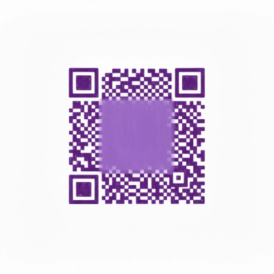
A malicious package uses a QR code as steganography in an innovative technique.
Research
/Security News
Socket identified 80 fake candidates targeting engineering roles, including suspected North Korean operators, exposing the new reality of hiring as a security function.