Research
/Security News
Critical Vulnerability in NestJS Devtools: Localhost RCE via Sandbox Escape
A flawed sandbox in @nestjs/devtools-integration lets attackers run code on your machine via CSRF, leading to full Remote Code Execution (RCE).
A collection of tools for working with shapefiles and converting them for Delft3D modeling
A collection of Python tools for working with shapefiles and converting them for Delft3D modeling.
CAUTION: The ncrain function currently only works for Taiwan data in EPSG:3826 projection.
GDAL Installation: GDAL is required for this package. For conda environments, use
conda install gdalto install GDAL. For non-conda environments, download the appropriate wheel file from https://github.com/cgohlke/geospatial-wheels/releases to install GDAL.
pip install d3dtools
This package provides several utilities for converting shapefiles to various formats used in Delft3D modeling:
from d3dtools import snorain

# Process a scenario rainfall CSV file
snorain.generate(
    input_file='rainfall_scenarios.csv',
    output_folder='custom/TAB',
    verbose=True
)
from d3dtools import ncrain

# Default usage - processes first CSV file in the input folder
ncrain.generate()

# With custom parameters
ncrain.generate(
    input_shp_folder='custom/SHP',
    input_tab_folder='custom/TAB',
    output_nc_folder='custom/NC',
    intermediate_ras_folder='custom/RAS_RAIN',
    intermediate_shp_folder='custom/SHP_RAIN',
    clean_intermediate=True,
    raster_resolution=320
)

# Process a specific CSV file
ncrain.generate(
    input_tab_folder='custom/TAB',
    rainfall_file='specific_rainfall.csv',
    verbose=True
)

# Process all CSV files in the input folder
ncrain.generate_all(
    input_shp_folder='custom/SHP',
    input_tab_folder='custom/TAB',
    output_nc_folder='custom/NC',
    verbose=True
)
from d3dtools import shpbc2pli

# Default usage
shpbc2pli.convert()

# With custom parameters
shpbc2pli.convert(
    input_folder='custom/SHP_BC',
    output_folder='custom/PLI_BC'
)

# With custom ID field name
shpbc2pli.convert(
    input_folder='custom/SHP_BC',
    output_folder='custom/PLI_BC',
    id_field='BoundaryName'  # Use 'BoundaryName' column instead of default 'ID'/'Id'/'id'/'iD'
)
from d3dtools import shpblock2pol

# Default usage
shpblock2pol.convert()

# With custom parameters
shpblock2pol.convert(
    input_folder='custom/SHP_BLOCK',
    output_folder='custom/POL_BLOCK'
)
from d3dtools import shpdike2pliz

# Default usage
shpdike2pliz.convert()

# With custom parameters
shpdike2pliz.convert(
    input_folder='custom/SHP_DIKE',
    output_folder='custom/PLIZ_DIKE',
    output_filename='CustomDike'
)

# With custom ID field name
shpdike2pliz.convert(
    input_folder='custom/SHP_DIKE',
    output_folder='custom/PLIZ_DIKE',
    output_filename='CustomDike',
    id_field='DikeName'  # Use 'DikeName' column instead of default 'ID'/'Id'/'id'/'iD'
)
from d3dtools import shp2ldb

# Default usage
shp2ldb.convert()

# With custom parameters
shp2ldb.convert(
    input_folder='custom/SHP_LDB',
    output_folder='custom/LDB'
)

# With custom ID field name
shp2ldb.convert(
    input_folder='custom/SHP_LDB',
    output_folder='custom/LDB',
    id_field='BoundaryName'  # Use 'BoundaryName' column instead of default 'ID'/'Id'/'id'/'iD'
)
from d3dtools import shp2xyz

# Default usage
shp2xyz.convert()

# With custom parameters
shp2xyz.convert(
    input_folder='custom/SHP_SAMPLE',
    output_folder='custom/XYZ_SAMPLE'
)

# With custom Z-field name
shp2xyz.convert(
    input_folder='custom/SHP_SAMPLE',
    output_folder='custom/XYZ_SAMPLE',
    z_field='ELEVATION'  # Use 'ELEVATION' column instead of default Z-field detection
)
from d3dtools import sensor

# Extract data from NetCDF file at observation points
data = sensor.getdata(
    nc_file='path/to/model_output.nc',
    obs_shp='path/to/observation_points.shp',
    output_csv='water_depth.csv',
    output_excel='water_depth.xlsx',
    plot=True  # Display a plot of the time series
)

# Process the data further if needed
print(data.head())
stats = data.describe().transpose()
print(stats)
from d3dtools import evaluate_sensor

# Compare simulated flood extents with sensor observations
results = evaluate_sensor.confusion_matrix(
    sim_path='path/to/simulated_flood.shp',
    obs_path='path/to/sensor_observations.shp',
    buffer_radius=30,               # Buffer radius around sensor points in meters (default: 30)
    depth_threshold=30,             # Water depth threshold in centimeters (default: 30)
    output_csv='sensor_accuracy.csv'
)

print(f"Accuracy: {results['accuracy']:.2f}%")
print(f"Recall (Catch Rate): {results['recall']:.2f}%")
from d3dtools import evaluate

# Compare simulated and observed flood extents
results = evaluate.confusion_matrix(
    sim_path='path/to/simulated_flood.shp',
    obs_path='path/to/observed_flood.shp',
    output_path='accuracy_results.csv'
)

print(f"Accuracy: {results['accuracy']:.2f}%")
print(f"Recall (Catch Rate): {results['recall']:.2f}%")
The package provides the d3dtools-info command-line utility that serves as a central information hub for all available tools:
# Display the package version
d3dtools-info --version

# Get help on d3dtools-info itself
d3dtools-info --help

# Display description of all available tools
d3dtools-info

# Display detailed information about a specific tool
d3dtools-info ncrain
d3dtools-info snorain
d3dtools-info shp2ldb
d3dtools-info shp2pli
d3dtools-info shp2pliz
d3dtools-info shp2pol
d3dtools-info shp2xyz
d3dtools-info shpbc2pli
d3dtools-info shpblock2pol
d3dtools-info shpdike2pliz
d3dtools-info sensor
d3dtools-info evaluate
d3dtools-info evaluate_sensor

# Display help for specific tools
ncrain --help
snorain --help
shp2ldb --help
shp2pli --help
shp2pliz --help
shp2pol --help
shp2xyz --help
shpbc2pli --help
shpblock2pol --help
shpdike2pliz --help
sensor --help
evaluate --help
evaluate_sensor --help
The d3dtools-info tool helps you discover available functionality, learn about tool options, and access usage examples without having to remember all command-line parameters.
The package also provides command-line utilities for each specific tool:
# Generate NetCDF from rainfall data
ncrain                      # Process all CSV files in the input folder
ncrain --shp-folder custom/SHP --tab-folder custom/TAB --nc-folder custom/NC --resolution 320
ncrain --verbose            # Display additional processing information
ncrain --no-clean           # Keep intermediate files
ncrain --single rainfall.csv  # Process only a specific CSV file

# Process rainfall scenario data
snorain -i rainfall_scenarios.csv -o custom/TAB
snorain --input rainfall_scenarios.csv --output custom/TAB --verbose

# Convert boundary shapefiles to LDB
shp2ldb
shp2ldb -i custom/SHP_LDB -o custom/LDB  # Specify input and output folders
shp2ldb --id_field BoundaryName  # Specify custom ID field

# Convert boundary shapefiles to PLI
shpbc2pli  # or use the alias: shp2pli
shpbc2pli --id_field BoundaryName  # Specify custom ID field

# Convert block shapefiles to POL
shpblock2pol  # or use the alias: shp2pol
shpblock2pol -i custom/SHP_BLOCK -o custom/POL_BLOCK  # Specify input and output folders

# Convert dike shapefiles to PLIZ
shpdike2pliz  # or use the alias: shp2pliz
shpdike2pliz --id_field DikeName  # Specify custom ID field

# Convert point shapefiles to XYZ
shp2xyz
shp2xyz -i custom/SHP_SAMPLE -o custom/XYZ_SAMPLE  # Specify input and output folders
shp2xyz --z_field ELEVATION  # Specify custom Z-field name

# Extract time series data at observation points
sensor --nc-file path/to/model_output.nc --obs-shp path/to/observation_points.shp
sensor --nc-file path/to/model_output.nc --obs-shp path/to/observation_points.shp --output-csv water_depth.csv --output-excel water_depth.xlsx --plot
sensor --verbose  # Display additional processing information

# Calculate flood simulation accuracy metrics
evaluate --sim path/to/simulated_flood.shp --obs path/to/observed_flood.shp
evaluate --sim path/to/simulated_flood.shp --obs path/to/observed_flood.shp --output accuracy_results.csv

# Calculate flood simulation accuracy using sensor data
evaluate_sensor --sim path/to/simulated_flood.shp --obs path/to/sensor_points.shp
evaluate_sensor --sim path/to/simulated_flood.shp --obs path/to/sensor_points.shp --buffer 30 --threshold 30 --output sensor_accuracy.csv
MIT
FAQs
A collection of tools for working with shapefiles and converting them for Delft3D modeling
We found that d3dtools demonstrated a healthy version release cadence and project activity because the last version was released less than a year ago. It has 1 open source maintainer collaborating on the project.
Did you know?

Socket for GitHub automatically highlights issues in each pull request and monitors the health of all your open source dependencies. Discover the contents of your packages and block harmful activity before you install or update your dependencies.

Research
/Security News
A flawed sandbox in @nestjs/devtools-integration lets attackers run code on your machine via CSRF, leading to full Remote Code Execution (RCE).

Product
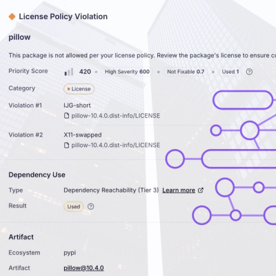
Customize license detection with Socket’s new license overlays: gain control, reduce noise, and handle edge cases with precision.

Product
Socket now supports Rust and Cargo, offering package search for all users and experimental SBOM generation for enterprise projects.