Research
/Security News
Critical Vulnerability in NestJS Devtools: Localhost RCE via Sandbox Escape
A flawed sandbox in @nestjs/devtools-integration lets attackers run code on your machine via CSRF, leading to full Remote Code Execution (RCE).

Validate GeoJSON and automatically fix invalid geometries. Like geojsonhint, but with geometry checks & fixes!

# Installation
pip install geojson-validator
Data input can be any type of GeoJSON object, a filepath/url, and anything with a __geo_interface__ (shapely, geopandas etc.).
import geojson_validator

geojson_input = {'type': 'FeatureCollection',
                 'features': [{'type': 'Feature', 'geometry':
                     {'type': 'Point', 'coordinates': [-59.758285, 8.367035]}}]}

geojson_validator.validate_structure(geojson_input)
geojson_validator.validate_geometries(geojson_input)
geojson_validator.fix_geometries(geojson_input)
Checks the structure & formatting of the GeoJSON, e.g. required elements, data & geometry types, coordinate array depth etc.
geojson_validator.validate_structure(geojson_input, check_crs=False)
Returns the reasons why the input does not conform to the GeoJSON specification.
Also gives the line location and feature index to more quickly localize the issues.
Example: {"Missing 'type' member": {"line": [4], "feature": [0]}.
Checks the GeoJSON geometry objects for inconsistencies and geometric issues. See geojson-invalid-geometry for a detailed description of all invalid and problematic criteria. You can choose to validate only specific criteria, by default all are selected.
# Invalid according to the GeoJSON specification
criteria_invalid = ["unclosed", "less_three_unique_nodes", "exterior_not_ccw",
                    "interior_not_cw", "inner_and_exterior_ring_intersect"]

# Problematic with some tools & APIs
criteria_problematic = ["holes", "self_intersection", "duplicate_nodes",
                        "excessive_coordinate_precision", "excessive_vertices",
                        "3d_coordinates", "outside_lat_lon_boundaries", "crosses_antimeridian"]

geojson_validator.validate_geometries(geojson, criteria_invalid, criteria_problematic)
Returns the reasons (example below) and positional indices of the invalid geometries, e.g. features [0, 3]. Also indicates if a
sub-geometry of a MultiType geometry make it invalid e.g. {2:[0, 5]}.
{"invalid":
      {"unclosed": [0, 3],
       "exterior_not_ccw":  [{2:[0, 5]}],
 "problematic":
      {"crosses_antimeridian": [1]},
 "count_geometry_types":
      {"Polygon": 3,
       "MultiPolygon": 1}}
Automatically repairs some of the most common categories of invalid geometries.
Always fixes ["unclosed", "exterior_not_ccw", "interior_not_cw"].
Select additional, non-essential fixes with the parameter optional.
More fixes and helper-functions (for issues that require user descisions) coming soon!
geojson_validator.fix_geometries(geojson_input, optional=["duplicate_nodes"])
The result is a GeoJSON FeatureCollection with the fixed geometries.
geojson_validator.configure_logger(enabled=True, level="DEBUG") which also returns the logger instance.FAQs
Validates and fixes GeoJSON
We found that geojson-validator demonstrated a healthy version release cadence and project activity because the last version was released less than a year ago. It has 1 open source maintainer collaborating on the project.
Did you know?

Socket for GitHub automatically highlights issues in each pull request and monitors the health of all your open source dependencies. Discover the contents of your packages and block harmful activity before you install or update your dependencies.

Research
/Security News
A flawed sandbox in @nestjs/devtools-integration lets attackers run code on your machine via CSRF, leading to full Remote Code Execution (RCE).

Product
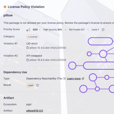
Customize license detection with Socket’s new license overlays: gain control, reduce noise, and handle edge cases with precision.

Product
Socket now supports Rust and Cargo, offering package search for all users and experimental SBOM generation for enterprise projects.