


Map2Loop 3.2
Generate 3D geological model inputs from geological maps — a high-level implementation and extension of the original map2loop code developed by Prof. Mark Jessell at UWA. To see an example interactive model built with map2loop and LoopStructural, follow this link:
3D Model from the Hamersley region, Western Australia
Install
Option 1: Install with Anaconda
This is the simplest and recommended installation process, with:
conda install -c loop3d -c conda-forge map2loop
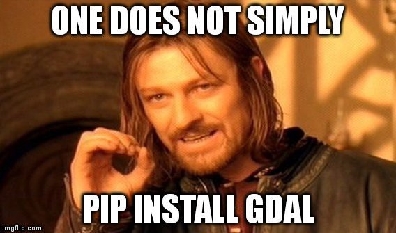
Option 2: Install with pip
Installation with pip will require that GDAL is installed on your system prior to map2loop installation.
This is because GDAL cannot be installed via pip (at least not with one line of code), and the GDAL installation process will vary depending on your OS.
For more information on installing gdal, see GDAL's Pypi page.
Once GDAL is available on your system, map2loop can be installed with:
pip install map2loop
Option 3: From source
git clone https://github.com/Loop3D/map2loop.git

cd map2loop

conda install gdal

conda install -c loop3d -c conda-forge --file dependencies.txt

pip install .
Option 4: From source & developer mode:
git clone https://github.com/Loop3D/map2loop.git

cd map2loop

conda install gdal

conda install -c loop3d -c conda-forge --file dependencies.txt

pip install -e .
Documentation
Map2loop's documentation is available here
Usage
Our notebooks cover use cases in more detail, but here is an example of processing Loop's South Australia remote geospatial data in just 20 lines of Python.
First, let's import map2loop and define a bounding box. You can use GIS software to find one or use Loop's Graphical User Interface for the best experience and complete toolset. Remember what projection your coordinates are in!
from map2loop.project import Project
from map2loop.m2l_enums import VerboseLevel
bbox_3d = {
'minx': 250805.1529856466,
'miny': 6405084.328058686,
'maxx': 336682.921539395,
'maxy': 6458336.085975628,
'base': -3200,
'top': 1200
}
Then, specify: the state, directory for the output, the bounding box and projection from above - and hit go! That's it.
proj = Project(use_australian_state_data = "SA",
               working_projection = 'EPSG:28354',
               bounding_box = bbox_3d,
               loop_project_filename = "output.loop3d"
               )

proj.run_all()
This is a minimal example and a small part of Loop.
Our documentation and other resources outline how to extend map2loop and port to the LoopStructural modelling engine. We are working to incorporate geophysical tools and best provide visualisation and workflow consolidation in the GUI.
Loop is led by Laurent Ailleres (Monash University) with a team of Work Package leaders from:
- Monash University: Roy Thomson, Lachlan Grose and Robin Armit
- University of Western Australia: Mark Jessell, Jeremie Giraud, Mark Lindsay and Guillaume Pirot
- Geological Survey of Canada: Boyan Brodaric and Eric de Kemp
Known Issues and FAQs
- Developing with docker on Windows means you won't have GPU passthrough and can’t use a discrete graphics card in the container even if you have one.
- If Jupyter links require a token or password, it may mean port 8888 is already in use. To fix, either make docker map to another port on the host ie -p 8889:8888 or stop any other instances on 8888.
Links
https://loop3d.github.io/
https://github.com/Loop3D/LoopStructural

