Research
Security News
Lazarus Strikes npm Again with New Wave of Malicious Packages
The Socket Research Team has discovered six new malicious npm packages linked to North Korea’s Lazarus Group, designed to steal credentials and deploy backdoors.
@trackcode/map
Advanced tools
A lightweight react package to interact with google maps.
npm install --save @trackcode/map
import React from "react";
import { Pin } from "@trackcode/map";

const MyMap = () => (
  <Map
    apiKey="YOU_API_KEY"
    libraries="places,geometry" // default "places"
    defaultZoom={14}
    defaultCenter={{ lat: 52.01525584, lng: 8.52046783 }}
  >
    <Pin label="A" position={{ lat: 52.02221556, lng: 8.53188536 }} />
  </Map>
);
Add this script tag to the <head> of your website:
<script src="https://maps.googleapis.com/maps/api/js?key=API_KEY&libraries=places"></script>
Example:
import React from "react";
import { Map, Pin, Driver } from "@trackcode/map";

const MyMap = () => (
  <div style={{ width: "350px", height: "400px" }}>
    <Map defaultZoom={14} defaultCenter={{ lat: 52.01525584, lng: 8.52046783 }}>
      <Pin label="A" position={{ lat: 52.02221556, lng: 8.53188536 }} />
      <Driver position={{ lat: 52.01757214, lng: 8.52521203 }} />
    </Map>
  </div>
);
<Map />Important component to show the map.
<Map
  defaultZoom={14}
  defaultCenter={{ lat: 52.01525584, lng: 8.52046783 }}
>
| Name | Type | Default | Description |
|---|---|---|---|
| apiKey | string | Google Maps api key. | |
| libraries | string | places | Define libraries for Google Maps. |
| version | string | places | Use specific Google Maps version. |
| children | any | @trackcode/map components e.g. <Pin />, <Driver /> | |
| defaultZoom * | number | Default zoom level | |
| defaultCenter * | object | Default center | |
| defaultCenter.lat | number | Latitude | |
| defaultCenter.lng | number | Longitude | |
| defaultFullscreenControl | boolean | true | The display options for the Fullscreen control. |
| defaultMapTypeControl | boolean | true | The initial enabled/disabled state of the Map type control. |
| defaultStreetViewControl | boolean | true | The initial enabled/disabled state of the Street View Pegman control. |
| defaultZoomControl | boolean | true | The enabled/disabled state of the Zoom control. |
* required
<Pin />A pin (or marker) to show a location on the map.
<Pin
  appearance="subtle"
  position={{ lat: 52.0277157, lng: 8.50419146 }}
/>
<Pin position={{ lat: 52.0287157, lng: 8.52419146 }} />
<Pin label="A" position={{ lat: 52.0287157, lng: 8.54419146 }} />
| Name | Type | Default | Description |
|---|---|---|---|
| appearance | string | "primary" | The base styling to apply to the Pin. Possible values are "primary", "subtle". |
| position * | Object | Set position | |
| position.lat | number | Latitude | |
| position.lng | number | Longitude | |
| label | string | Set label | |
| onClick | function | Handle click event. |
* required
<Driver />Show a driver point on map. This component is able to animate position changes in a smooth way.
<Driver position={{ lat: 52.0287157, lng: 8.52419146 }} />
<Driver active={false} title="Inactive" position={{ lat: 52.0287157, lng: 8.53419146 }} />
| Name | Type | Default | Description |
|---|---|---|---|
| position * | Object | Set position | |
| position.lat | number | Latitude | |
| position.lng | number | Longitude | |
| title | string | Show a title tooltip | |
| active | boolean | true | Blur color for active and gray if it's inactive |
* required
<Directions />Show directions on map.
<Directions
  origin={{
    location: { lat: 52.012054, lng: 8.537375 },
  }}
  wayPoints={[{ location: "Herforder Straße 1, Bielefeld" }]}
  destination={{
    location: "Siegfriedstr. 18, Bielefeld",
  }}
/>
| Name | Type | Default | Description |
|---|---|---|---|
| origin * | Object | Settings for origin | |
| origin.location | String | LatLng | Location of origin | |
| destination * | Object | Settings for destination | |
| destination.location | String | LatLng | Location of origin | |
| wayPoints | Array | Way points between origin and destination | |
| wayPoints[].location | String | LatLng | Settings of a way point | |
| autoFitBounds | Boolean | true | Fit bounds based on direction path |
Type: (Object) LatLng
| Name | Type | Description |
|---|---|---|
| lat | number | Latitude |
| lng | number | Longitude |
* required
<Polygon />Show polygon on map.
<Polygon
  positions={[
    { lat: 52.01525584, lng: 8.52046783 },
    { lat: 52.02382442, lng: 8.52382776 },
    { lat: 52.02029969, lng: 8.53465948 },
    { lat: 52.00129969, lng: 8.53465948 },
    { lat: 52.01665505, lng: 8.55311308 },
    { lat: 52.0192433, lng: 8.55328474 },
  ]}
/>
| Name | Type | Default | Description |
|---|---|---|---|
| positions * | Array | List of LatLng positions. | |
| positions[].lat | number | Latitude | |
| positions[].lng | number | Longitude | |
| useConvexHull | Boolean | true | Use "convex hull" to draw outline polygon of a set of positions. |
* required
FAQs
<!-- STORY -->
We found that @trackcode/map demonstrated a not healthy version release cadence and project activity because the last version was released a year ago. It has 2 open source maintainers collaborating on the project.
Did you know?

Socket for GitHub automatically highlights issues in each pull request and monitors the health of all your open source dependencies. Discover the contents of your packages and block harmful activity before you install or update your dependencies.

Research
Security News
The Socket Research Team has discovered six new malicious npm packages linked to North Korea’s Lazarus Group, designed to steal credentials and deploy backdoors.

Security News
Socket CEO Feross Aboukhadijeh discusses the open web, open source security, and how Socket tackles software supply chain attacks on The Pair Program podcast.

Security News
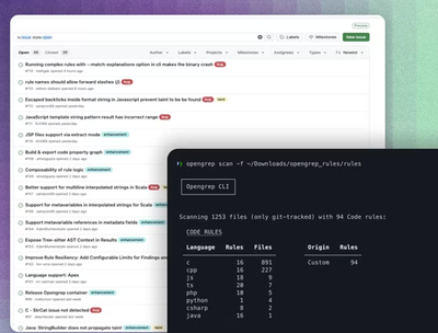
Opengrep continues building momentum with the alpha release of its Playground tool, demonstrating the project's rapid evolution just two months after its initial launch.