Research
Security News
Lazarus Strikes npm Again with New Wave of Malicious Packages
The Socket Research Team has discovered six new malicious npm packages linked to North Korea’s Lazarus Group, designed to steal credentials and deploy backdoors.
cross-street-indexer
Advanced tools
Blazing fast tile based geocoder that matches cross street (road intersections) entirely sourced by OSM QA Tiles.
Blazing fast tile based geocoder that matches cross street (road intersections) entirely sourced by OSM QA Tiles.

lib/qa-tiles-filter.js)lib/intersections.js)ABBOT AVE. => abbot avenue (lib/normalize.js)road & ref tags (lib/geocoding-pairs).lib/reducer.js)bin/cross-street-indexer.js)bin/cross-street-search.js)s3://cross-street-index/latest/<quadkey>.jsonUsers can download the entire planet or country extracts of OSM QA Tiles from https://osmlab.github.io/osm-qa-tiles.

npm
$ npm install --global cross-street-indexer
yarn
$ yarn global add cross-street-indexer
$ cross-street-indexer latest.planet.mbtiles --tiles [[654,1584,12]]
$ cross-street-search "Chester St" "ABBOT AVE." --tiles [[654,1584,12]]
-122.457711,37.688544
$ cross-street-indexer --help

  Cross Street Indexer

  Usage:
    $ cross-street-indexer <qa-tiles>
  Options:
    --output    [cross-street-index] Filepath to store outputs
    --bbox      Excludes QATiles by BBox
    --tiles     Excludes QATiles by an Array of Tiles
    --debug     [false] Enables DEBUG mode
  Examples:
    $ cross-street-indexer latest.planet.mbtiles
    $ cross-street-indexer latest.planet.mbtiles --tiles [[654,1584,12]]
    $ cross-street-indexer latest.planet.mbtiles --bbox [-122.519,37.629,-122.168,37.917]
$ cross-street-search --help

  Cross Street Indexer

  Usage:
    $ cross-street-search <name1> <name2>
  Options:
    --output    [cross-street-index] filepath to Cross Street index output folder
    --tiles     Lookup index files via an Array of Tiles or Quadkeys
    --bbox      Lookup index files via BBox
    --latlng    Outputs LatLng instead of the default LngLat
    --stream    Enables reading from streaming index file (ignores tiles/bbox options)
  Examples:
    $ cross-street-search "Chester St" "ABBOT AVE." --tiles [[654,1584,12],[653,1585,12]]
    $ cross-street-search "Chester St" "ABBOT AVE." --tiles "023010221110,023010221110"
    $ cross-street-search "Chester St" "ABBOT AVE." --bbox [-122.5,37.6,-122.1,37.9]
    $ cat 023010221110.json | cross-street-search "Chester St" "ABBOT AVE."
    $ curl -s https://s3.amazonaws.com/cross-street-index/latest/023010221110.json | cross-street-search "Chester St" "ABBOT AVE." --stream
Normalization should follow the following standards:
The Cross Street Index is stored in an easy to read key/value JSON Lines format.
<name1>+<name2>){"abbot avenue+chester street":[-122.457711,37.688544]}
{"chester street+abbot avenue":[-122.457711,37.688544]}
{"chester street+lisbon street":[-122.45821,37.68796]}
{"lisbon street+chester street":[-122.45821,37.68796]}
{"hoffman street+lisbon street":[-122.456764,37.687179]}
name:en & name:fr, etc...abbot avenue+chester streetabbot+chesterabbot avenue+chesterabbot+chester streetHWY 417 => highway 417Highway 417 => highway 417ST 130 => st 130CA 130 => ca 130! instead of + as separator (less common to have a ! in a name)ref & name ("CA 131" => ["ca 131", 131])rodeo avenue => [rodeo avenue, rodeo])\n at the bottom of the file (helps concatenate streams together).name & ref code with ; into Array of names.\n at the end (-122,37\n or -122,37)name: Street name (Abbot Avenue)ref Reference number normaly used to tag highways numbershighway classification (residential, primary, secondary)bridge yes/notunnel yes/no@id OSM ID of street (way)Including --debug will store additional files for each QA-Tile which can be helpful for debugging.
<output>/<quadkey>.json - Cross Street index cache<output>/<quadkey>/lines.geojson - Filtered (Multi)LinesString from QA-Tile<output>/<quadkey>/intersects.geojson - Point which are intersecting roads<output>/<quadkey>/debug.json - Debug detailsdebug.json
{
	"tile": [
		654,
		1584,
		12
	],
	"quadkey": "023010221110",
	"features": 49003,
	"lines": 2427,
	"intersects": 1921,
	"index": 3882
}
FAQs
Blazing fast tile based geocoder that matches cross street (road intersections) entirely sourced by OSM QA Tiles.
The npm package cross-street-indexer receives a total of 0 weekly downloads. As such, cross-street-indexer popularity was classified as not popular.
We found that cross-street-indexer demonstrated a not healthy version release cadence and project activity because the last version was released a year ago. It has 1 open source maintainer collaborating on the project.
Did you know?

Socket for GitHub automatically highlights issues in each pull request and monitors the health of all your open source dependencies. Discover the contents of your packages and block harmful activity before you install or update your dependencies.

Research
Security News
The Socket Research Team has discovered six new malicious npm packages linked to North Korea’s Lazarus Group, designed to steal credentials and deploy backdoors.

Security News
Socket CEO Feross Aboukhadijeh discusses the open web, open source security, and how Socket tackles software supply chain attacks on The Pair Program podcast.

Security News
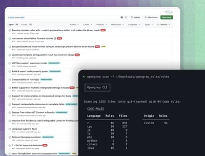
Opengrep continues building momentum with the alpha release of its Playground tool, demonstrating the project's rapid evolution just two months after its initial launch.