Security News
Feross on Risky Business Weekly Podcast: npm’s Ongoing Supply Chain Attacks
Socket CEO Feross Aboukhadijeh joins Risky Business Weekly to unpack recent npm phishing attacks, their limited impact, and the risks if attackers get smarter.
geo-search-helper
Advanced tools
Helper functions for geographical search, displaying, filtering and sorting.
With this you'll be able to sort search results on shortest to longest distance from your position or some other chosen position. And show i.e. the 10 closest search results or all the search results within a given distance from your position or some other chosen position. Will be possible to do sorting on numbers in version 3 of search-index.
<script src="geo-search-helper-umd.js"></script>
<!-- gsh.mapBoundsPosKm, gsh.mapBoundsPoints, gsh.getDistanceFromLatLonInKm available -->
<script src="https://cdn.jsdelivr.net/npm/geo-search-helper@0.2.1/dist/geo-search-helper.umd.min.js"></script>
<!-- gsh.mapBoundsPosKm, gsh.mapBoundsPoints, gsh.getDistanceFromLatLonInKm available -->
<script type="module">
   import { mapBoundsPosKm, mapBoundsPoints, getDistanceFromLatLonInKm } from 'geo-search-helper.esm.mjs'
</script>
<script type="module">
   import { mapBoundsPosKm, mapBoundsPoints, getDistanceFromLatLonInKm } from 'https://cdn.jsdelivr.net/npm/geo-search-helper/dist/geo-search-helper.esm.min.mjs'
</script>
const { getDistanceFromLatLonInKm, mapBoundsPoints, mapBoundsPosKm } = require('geo-search-helper')
First you get a search result, calculate distance from point of interest and sort it on smallest to highest distance.
Then there is two ways of using the library. Either your use case is to show search results within a given distance, or show [n] search results.
For search results within a given distance, you cut of the results biggere than that given distance and find map bounds with mapBoundsPosKm() to be able to show the search results on a map.

For showing the first [n] search results, you use mapBoundsPoints() to be able to show the search results on a map.

getDistanceFromLatLonInKm({fromPointObj}, {toPointObj})
Returns shortest distance over the earth’s surface – using the ‘Haversine’ formula. Result in kilometers. To i.e. sort a search result from a point on the map.
mapBoundsPosKm({fromPointObj}, radius)Returns object with coordinates of map boundaries based on given position and radius from that position.


mapBoundsPoints([poinstArray], ['keyLatValue'], ['keyLonValue'])Returns object with coordinates of map boundaries based on area covered by an array of geographical points. Needs two or more points to work.
For latitude and longitude in nested objects like:
const data = [
  {
    id: '14272199162',
    geo: {
      latitude: 59.907427,
      longitude: 10.785616
    },
    url: 'https://live.staticflickr.com/5513/14272199162_e7547e4394_b.jpg',
    height: 1024,
    width: 1024,
    urlphotopage: 'https://flickr.com/photos/breial/14272199162'
  }
]
You can access the latitude by calling ['geo', 'latitude'] fro latitude and ['geo', 'longitude'] for longitude.


Browser focus with ESM and UMD, three functions:
The fromPointObj can be your current position or something else, like one of the search results.
// Position options
const getPositionOpt = {
   enableHighAccuracy: true,
   timeout: 5000,
   maximumAge: 0
}

// Position promise
function getPosition() {
   return new Promise((res, rej) => {
      navigator.geolocation.getCurrentPosition(res, rej, getPositionOpt)
   })
}

// Tying all the position stuff together
function getPositionCallback() {
   getPosition()
   // format position object
   .then((pos) => {
      const crd = pos.coords;
      const position = { lat: crd.latitude, lon: crd.longitude, acc: crd.accuracy }
      return position
   })
   // Do your stuff here
   .then((position) => {
      populateHTML(position)
      console.log(position)
   })
   // Handle errors
   .catch((err) => {
      console.log(err)
      const error = { errortype: err.code, errormessage: err.message }
      populateHTML(error)
      return error
   })
}

function showMap(position) {
   const map = L.map('map',
   {
      center: [position.lat, position.lon],
      zoom: 10
   }
   );
   L.tileLayer('http://{s}.tile.osm.org/{z}/{x}/{y}.png').addTo(map);
}

// Dummy HTML populate
function populateHTML(msg) {
   const node = document.createElement('span').innerText = JSON.stringify(msg, 2, ' ')
   document.getElementById('pos').replaceChildren(node)
}

// Fire up the position magic
getPositionCallback()
When map shown is not square, the square mapview will be within the boundaries of the horisontal or vertical map. Not a big problem, but okay to know about.

FAQs
Helper functions for geographical search within search-index.
We found that geo-search-helper demonstrated a not healthy version release cadence and project activity because the last version was released a year ago. It has 1 open source maintainer collaborating on the project.
Did you know?

Socket for GitHub automatically highlights issues in each pull request and monitors the health of all your open source dependencies. Discover the contents of your packages and block harmful activity before you install or update your dependencies.

Security News
Socket CEO Feross Aboukhadijeh joins Risky Business Weekly to unpack recent npm phishing attacks, their limited impact, and the risks if attackers get smarter.

Product
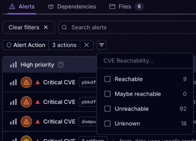
Socket’s new Tier 1 Reachability filters out up to 80% of irrelevant CVEs, so security teams can focus on the vulnerabilities that matter.

Research
/Security News
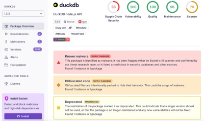
Ongoing npm supply chain attack spreads to DuckDB: multiple packages compromised with the same wallet-drainer malware.