Research
Security News
Lazarus Strikes npm Again with New Wave of Malicious Packages
The Socket Research Team has discovered six new malicious npm packages linked to North Korea’s Lazarus Group, designed to steal credentials and deploy backdoors.
leaflet-tilelayer-swiss
Advanced tools
Leaflet.TileLayer.Swiss is a Leaflet plugin for displaying national maps of Switzerland using map tiles from Swisstopo.
Leaflet.TileLayer.Swiss is a Leaflet plugin for displaying national maps of Switzerland using map tiles from Swisstopo. This plugin is not affiliated with or endorsed by Swisstopo.
Check out the quick start documentation to get started.
Check out the list of all available map layers to see recommended combinations of options.
All available options are listed below together with their default values.
L.tileLayer.swiss({
// Coordinate reference system. EPSG2056 and EPSG21781 are available.
crs: L.CRS.EPSG2056
// Image format (jpeg or png). Only one format is available per layer.
format: 'jpeg',
// Layer name.
layer: 'ch.swisstopo.pixelkarte-farbe',
// Minimum zoom. Levels below 14 exist for technical reasons,
// but you probably do not want to use them.
minZoom: 14,
// Maximum zoom. Availability of zoom levels depends on the layer.
maxNativeZoom: 27,
// Timestamp. Most (but not all) layers have a 'current' timestamp.
// Some layers have multiple versions with different timestamps.
timestamp: 'current',
// Map tile URL. Appropriate defaults are chosen based on the crs option.
url: 'https://wmts{s}.geo.admin.ch/1.0.0/{layer}/default/{timestamp}/2056/{z}/{x}/{y}.{format}'
});
Two CRS are commonly used in Switzerland:
In order to use EPSG:21781, both map and layer CRS have to be adapted:
var map = L.map('map', { crs: L.CRS.EPSG21781 });
var swissLayer = L.tileLayer.swiss({ crs: L.CRS.EPSG21781 }).addTo(map);

map.setView(L.CRS.EPSG21781.unproject(L.point(600000, 200000)), 16);
Since 2021-03-01, Swisstopo maps are available as Open Government Data (OGD), and Swisstopo also provides a free tile service, for which no registration is required. In practice, this means that you can directly start using this plugin, and with the default configuration, the map will be loaded directly from Swisstopo servers.
Swisstopo, like most map tile providers, requires that you display a copyright attribution below the map.
This plugin adds a map attribution which links to Swisstopo.
This plugin is licensed under the MIT license, see the LICENSE file.
Thanks to Swisstopo and the Geoinformation Act for providing excellent geodata.
Thanks to @procrastinatio whose blog post taught me how to use Swisstopo layers in Leaflet a few year ago.
FAQs
Leaflet.TileLayer.Swiss is a Leaflet plugin for displaying national maps of Switzerland using map tiles from Swisstopo.
The npm package leaflet-tilelayer-swiss receives a total of 299 weekly downloads. As such, leaflet-tilelayer-swiss popularity was classified as not popular.
We found that leaflet-tilelayer-swiss demonstrated a not healthy version release cadence and project activity because the last version was released a year ago. It has 2 open source maintainers collaborating on the project.
Did you know?

Socket for GitHub automatically highlights issues in each pull request and monitors the health of all your open source dependencies. Discover the contents of your packages and block harmful activity before you install or update your dependencies.

Research
Security News
The Socket Research Team has discovered six new malicious npm packages linked to North Korea’s Lazarus Group, designed to steal credentials and deploy backdoors.

Security News
Socket CEO Feross Aboukhadijeh discusses the open web, open source security, and how Socket tackles software supply chain attacks on The Pair Program podcast.

Security News
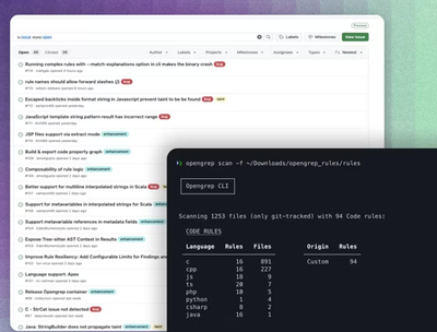
Opengrep continues building momentum with the alpha release of its Playground tool, demonstrating the project's rapid evolution just two months after its initial launch.