Security News
PodRocket Podcast: Inside the Recent npm Supply Chain Attacks
Socket CEO Feross Aboukhadijeh discusses the recent npm supply chain attacks on PodRocket, covering novel attack vectors and how developers can protect themselves.
three-slippy-map-globe
Advanced tools
A ThreeJS mesh to render tiled raster images onto a sphere using slippy map mechanics, with automatic detection of zoom level and tiles in view based on camera aim and proximity.
Check out the example (source).
import SlippyMapGlobe from 'three-slippy-map-globe';
or using a script tag
<script src="//unpkg.com/three-slippy-map-globe"></script>
then
const myMap = new SlippyMapGlobe(100, {
  tileUrl: (x, y, l) => `https://tile.openstreetmap.org/${l}/${x}/${y}.png`
});

const myScene = new THREE.Scene();
myScene.add(myMap);
and on camera position changes:
controls.addEventListener('change', () => {
  myMap.updatePov(camera);
});
new SlippyMapGlobe(globeRadius: float, { configOptions })
| Config options | Description | Default |
|---|---|---|
| tileUrl: fn(x, y, l) | The callback function that defines the URL of the tile engine, invoked for each single tile that needs fetching. The slippy map coordinates x, y and l (zoom level) are passed as arguments and the function is expected to return a URL string. | - |
| minZoom: int | The minimum zoom level of the tiles. | 0 |
| maxZoom: int | The maximum zoom level of the tiles. | 17 |
| mercatorProjection: boolean | Whether the tile images use a mercator projection. This is usually true for slippy maps tile sets. | true |
| Attribute | Description | Default |
|---|---|---|
| tileUrl: fn(x, y, l) | The callback function that defines the URL of the tile engine, invoked for each single tile that needs fetching. The slippy map coordinates x, y and l (zoom level) are passed as arguments and the function is expected to return a URL string. | - |
| minZoom: int | The minimum zoom level of the tiles. | 0 |
| maxZoom: int | The maximum zoom level of the tiles. | 17 |
| thresholds: float[] | The list of zoom level shifting thresholds, based on camera proximity to the surface, specified in globe radius units. | [8, 4, 2, 1, 0.5, 0.25, ...] |
| level: int | The current zoom level the map is in. Can be modified to manually shift zoom levels. | 0 |
| Method | Description |
|---|---|
| updatePov(camera) | Reports the current position of the camera to this component. The camera object in use should be passed as sole argument. This is necessary to internally calculate which tiles are in view and need to be fetched, as well as controlling automatic zoom level changes. This method should be called everytime the camera changes position, so that the tiles in view and zoom level remains synchronized with what the viewport is showing. |
| clearTiles() | Removes all the tiles across all zoom levels currently loaded on the map. |
 If this project has helped you and you'd like to contribute back, you can always buy me a ☕!
FAQs
Tiled maps on a globe as a ThreeJS reusable 3D object
The npm package three-slippy-map-globe receives a total of 41,317 weekly downloads. As such, three-slippy-map-globe popularity was classified as popular.
We found that three-slippy-map-globe demonstrated a healthy version release cadence and project activity because the last version was released less than a year ago. It has 1 open source maintainer collaborating on the project.
Did you know?

Socket for GitHub automatically highlights issues in each pull request and monitors the health of all your open source dependencies. Discover the contents of your packages and block harmful activity before you install or update your dependencies.

Security News
Socket CEO Feross Aboukhadijeh discusses the recent npm supply chain attacks on PodRocket, covering novel attack vectors and how developers can protect themselves.

Security News
Maintainers back GitHub’s npm security overhaul but raise concerns about CI/CD workflows, enterprise support, and token management.

Product
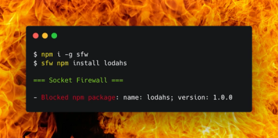
Socket Firewall is a free tool that blocks malicious packages at install time, giving developers proactive protection against rising supply chain attacks.