Research
Security News
Lazarus Strikes npm Again with New Wave of Malicious Packages
The Socket Research Team has discovered six new malicious npm packages linked to North Korea’s Lazarus Group, designed to steal credentials and deploy backdoors.
vue-geojson-view-ts
Advanced tools
Paquete para el uso de mapas con openstreetmap y geojson con VITE & VUE
Instalacion del paquete
npm i vue-geojson-view-ts
Configuracion para la creacion de polygonos dentro del mapa
<template>
    <div>
        <MapView :configurationMap="configurationMap" :coordinatesMap="coordinatesMap" :getGeoJSON="getGeoJSON"  :getCoodMarker="getCoodMarker"></MapView>
    </div>
</template>

<script setup lang="ts">
import { MapView } from 'vue-geojson-view-ts'
import { ref } from 'vue';

const iconMarker = {
  iconUrl:'/images/icon.png'.
  iconSize: [25, 41],
  iconAnchor: [12, 41],
}

const configurationMap = {
  height:'500px',
  iconMarker:{
    iconUrl:'https://cdn.onlinewebfonts.com/svg/img_466240.png',
    iconSize: [25, 41],
    iconAnchor: [12, 41],
  },
  maxZoom:19,
  renderMarker:true,
  dragMarker:true,
  createFigures:{
    polygon: true,
    circle: true,
    rectangle: true,
    marker:true,
  },
  editFigures:{
    edit: true,
    remove: true
  }
}
const coordinatesMap = ref([-19.0382054,-65.2662444,13])

const getGeoJSON = (geojson:any) =>{
  console.log(geojson)
}
const getCoodMarker = (lat:number,long:number) =>{
  console.log(lat,long)
}


</script>

<style>
 @import url(/node_modules/vue-geojson-view-ts/dist/style.css);
</style>
Configuracion para la edicion o solo vista de polygonos dentro del mapa
<template>
    <div>
        <MapView :loadPolygon="true" :dataPolygon="dataPolygon" :reverseCoordinatesPolygon="true" :configurationMap="configurationMap" :coordinatesMap="coordinatesMap" :getGeoJSON="getGeoJSON"></MapView>
    </div>
</template>

<script setup lang="ts">
import { MapView } from 'vue-geojson-view-ts'
import { ref } from 'vue';

const iconMarker = {
  iconUrl:'/images/icon.png'.
  iconSize: [25, 41],
  iconAnchor: [12, 41],
}

const configurationMap = {
  height:'500px',
  iconMarker:{
    iconUrl:'https://cdn.onlinewebfonts.com/svg/img_466240.png',
    iconSize: [25, 41],
    iconAnchor: [12, 41],
  },
  maxZoom:19,
  renderMarker:true,
  dragMarker:false,
  createFigures:{
    polygon: false,
    rectangle: false,
    marker:false,
  },
  editFigures:{
    edit: false,
    remove: false
  }
}

const coordinatesMap = ref([-19.0382054,-65.2662444,13])

const getGeoJSON = (geojson:any) =>{
  console.log(geojson)
}

const dataPolygon =[{"type":"Feature","properties":{},
"geometry":{"type":"Polygon","coordinates":[
  [[-65.268488,-19.038266],[-65.25703,-19.034128],[-65.256085,-19.039361],[-65.268788,-19.043337],[-65.268488,-19.038266]]
]}}] //

</script>

<style>
 @import url(/node_modules/vue-geojson-view-ts/dist/style.css);
</style>
Configuracion para ejecutar el disparador que guarda el polygono desde un boton fuera del mapa
<template>
  <div>
    <button @click="SaveEdit">Trigger Save Edit</button>
    <div style="display:flex;width: 100%;">
        <div style="width:30%">
          <MapView :loadPolygon="true" ref="Ref_MapView" :dataPolygon="dataPolygon" :reverseCoordinatesPolygon="true" :configurationMap="configurationMap" :coordinatesMap="coordinatesMap" :getGeoJSON="getGeoJSON"></MapView>
    </div>
  </div>
</template>

<script setup lang="ts">
import {MapView} from "vue-geojson-view-ts"
import { ref } from "vue";
const Ref_MapView = ref();
const configurationMap = {
  height:'500px',
  iconMarker:{
    iconUrl:'https://cdn.onlinewebfonts.com/svg/img_466240.png',
    iconSize: [25, 41],
    iconAnchor: [12, 41],
  },
  maxZoom:19,
  renderMarker:true,
  dragMarker:false,
  createFigures:{
    polygon: false,
    rectangle: false,
    marker:false,
  },
  editFigures:{
    edit: true,
    remove: true
  }
}
const coordinatesMap = [-19.0382054,-65.2662444,13]

const getGeoJSON = (geojson:any) =>{
  ////Los datos seran enviados a este callback desde el boton dentro del mapa como desde el TRIGGER
  console.log("geojson",geojson)
}

const SaveEdit = () =>{
  Ref_MapView.value.triggerSaveEdit()
}

const getLayersFeatures = () =>{
  const getLayersToGeoJson = Ref_MapView.value.getLayersFeaturesInGeoJson()
  console.log(getLayersToGeoJson)
}
</script>
Configuracion para ver si un punto esta dentro de un polygono
<template>
    <div>
        <CoordinatesVerifyPolygon :dataPolygon="dataPolygon" :coordinatesMap="coordinatesMap" :iconMarker="iconMarker" :checkPointInPolygon = "checkPointInPolygon"/>
    </div>
</template>

<script setup lang="ts">

const iconMarker = {
  iconUrl:'/images/icon.png'.
  iconSize: [25, 41],
  iconAnchor: [12, 41],
}

const coordinatesMap = ref([-19.0382054,-65.2662444,13])

const checkPointInPolygon = (check:Boolean) =>{
  console.log(check)
}

const dataPolygon = {"type":"Feature","properties":{},
"geometry":{"type":"Polygon","coordinates":[
  [[-65.268488,-19.038266],[-65.25703,-19.034128],[-65.256085,-19.039361],[-65.268788,-19.043337],[-65.268488,-19.038266]]
]}}

</script>

<style>
 @import url(/node_modules/vue-geojson-view-ts/dist/style.css);
</style>
Configuracion para el uso del buscador de direcciones de googlemaps
import {listenServiceGoogleMaps} from 'vue-geojson-view-ts'
import { onMounted } from 'vue';

onMounted(() => {
  listenServiceGoogleMaps()
});
<template>
    <div>
      <MapView :configurationMap="configurationMap" :coordinatesMap="coordinatesMap" :getGeoJSON="getGeoJSON"  :getCoodMarker="getCoodMarker"></MapView>
    </div>
    <button @click="manualGoogleMaps">manual</button>
    <button @click="automaticGoogleMaps">automatic</button>
</template>

<script setup lang="ts">
import {searchAutomaticGoogleMaps,searchManualGoogleMaps} from 'vue-geojson-view'
import { ref } from 'vue';

const coordinatesMap = ref([-19.0382054,-65.2662444,13])

const manualGoogleMaps = () =>{
    searchManualGoogleMaps().then(cood =>{
        coordinatesMap.value = cood
    }).catch(e=>{
        throw e
    })
}

const automaticGoogleMaps = () =>{
      searchAutomaticGoogleMaps('Santa Cruz, Bolivia').then(cood=>{
        coordinatesMap.value = cood
      }).catch(e=>{
          throw e
      })
}
</script>
<template>
    <div>
        <MapSearchAddress :coordinatesMap="coordinatesMap" @updated:coordsMarker="getCoodMarker"
        ref="mapRef"
        />
    </div>
</template>

<script setup lang="ts">

const configurationMap: IConfigurationMap = {
  height: "500px",
  maxZoom: 19,
  renderMarker:true,
  dragMarker:false,
  iconMarker: {
    iconUrl: "https://cdn.onlinewebfonts.com/svg/img_466240.png",
    iconSize: [25, 41],
    iconAnchor: [12, 41],
  },
};

const mapRef = ref()

const coordinatesMap = ref({
  lat: -19.0382054,
  lng: -65.2662444,
  zoom: 15,
})

const getCoodMarker = ({ lat, lng }: { lat: number; lng: number }) => {
  console.log("coord", lat, lng);
};

// mapRef.value.searchAddress(query:string)
// mapRef.value.searchAddress("Bolivia, Sucre, Bustillos 282");
// En caso de encontrar una dirección, envia el marcador a la nueva posición y actualiza
// el marcador via el emit  @updated:coordsMarker

</script>

<style>
 @import url(/node_modules/vue-geojson-view-ts/dist/style.css);
</style>
FAQs
Paquete para el uso de mapas con openstreetmap y geojson con VITE & VUE
We found that vue-geojson-view-ts demonstrated a not healthy version release cadence and project activity because the last version was released a year ago. It has 3 open source maintainers collaborating on the project.
Did you know?

Socket for GitHub automatically highlights issues in each pull request and monitors the health of all your open source dependencies. Discover the contents of your packages and block harmful activity before you install or update your dependencies.

Research
Security News
The Socket Research Team has discovered six new malicious npm packages linked to North Korea’s Lazarus Group, designed to steal credentials and deploy backdoors.

Security News
Socket CEO Feross Aboukhadijeh discusses the open web, open source security, and how Socket tackles software supply chain attacks on The Pair Program podcast.

Security News
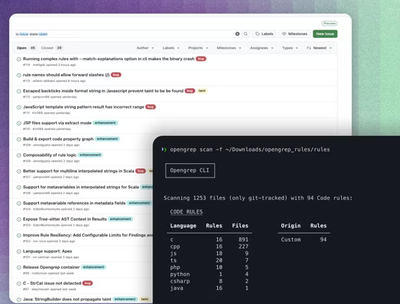
Opengrep continues building momentum with the alpha release of its Playground tool, demonstrating the project's rapid evolution just two months after its initial launch.