Research
2025 Report: Destructive Malware in Open Source Packages
Destructive malware is rising across open source registries, using delays and kill switches to wipe code, break builds, and disrupt CI/CD.
geojsoncontour
Advanced tools
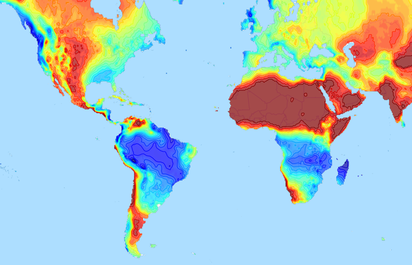
A Python 3 module to convert matplotlib contour plots to geojson. Supports both contour and contourf plots.
Designed to show geographical contour plots, created with matplotlib/pyplot, as vector layer on interactive slippy maps like OpenLayers and Leaflet.
Demo project that uses geojsoncontour: climatemaps.romgens.com

Install with pip,
pip install geojsoncontour
Use contour_to_geojson to create a geojson with contour lines from a matplotlib.contour plot (not filled).
Use contourf_to_geojson to create a geojson with filled contours from a matplotlib.contourf plot.
import numpy
import matplotlib.pyplot as plt
import geojsoncontour

# Create contour data lon_range, lat_range, Z
<your code here>

# Create a contour plot plot from grid (lat, lon) data
figure = plt.figure()
ax = figure.add_subplot(111)
contour = ax.contour(lon_range, lat_range, Z, cmap=plt.cm.jet)

# Convert matplotlib contour to geojson
geojson = geojsoncontour.contour_to_geojson(
    contour=contour,
    ndigits=3,
    unit='m'
)
For filled contour plots (matplotlib.contourf) use contourf_to_geojson.
See example_contour.py and example_contourf.py for simple but complete examples.
An easy way to show the generated geojson on a map is the online geojson renderer geojson.io or geojson.tools.
Stroke color and width are set as geojson properties following https://github.com/mapbox/simplestyle-spec.
Try geojson-vt or tippecanoe if performance is an issue and you need to tile your geojson contours.
Run all tests,
python -m unittest discover
Install setuptools, wheel and twine:
python -m pip install --upgrade setuptools wheel twine
Increase the version number in setup.py.
Create dist:
python setup.py sdist bdist_wheel
Upload:
twine upload dist/*
FAQs
Convert matplotlib contour plots to geojson
We found that geojsoncontour demonstrated a healthy version release cadence and project activity because the last version was released less than a year ago. It has 3 open source maintainers collaborating on the project.
Did you know?

Socket for GitHub automatically highlights issues in each pull request and monitors the health of all your open source dependencies. Discover the contents of your packages and block harmful activity before you install or update your dependencies.

Research
Destructive malware is rising across open source registries, using delays and kill switches to wipe code, break builds, and disrupt CI/CD.

Security News
Socket CTO Ahmad Nassri shares practical AI coding techniques, tools, and team workflows, plus what still feels noisy and why shipping remains human-led.

Research
/Security News
A five-month operation turned 27 npm packages into durable hosting for browser-run lures that mimic document-sharing portals and Microsoft sign-in, targeting 25 organizations across manufacturing, industrial automation, plastics, and healthcare for credential theft.