

Security News
pnpm 12’s Rust Rewrite Cuts Install Times by Up to 90%
pnpm 12 rewrites the package manager in Rust, cutting install times by up to 90% while preserving pnpm 11 workflows and lockfiles.
By Sarah Gooding - Sep 01, 2026
@strata-packages/shopmap
Advanced tools
Lightweight, theme-aware map component with terrain, hypsometric tinting, and procedural hillshading. Zero API keys. Free for commercial use.

A lightweight, theme-aware map component for shop location pages — with terrain, hypsometric tinting, and procedural hillshading built in. Zero API keys. All default data sources are free for commercial use.
--map-*, --st-* (Strata), and --bs-* (Bootstrap) variables automatically.pmtiles filenpx @strata-packages/shopmap init
<link rel="stylesheet" href="https://unpkg.com/maplibre-gl@4/dist/maplibre-gl.css" />
<script src="https://unpkg.com/maplibre-gl@4/dist/maplibre-gl.js"></script>
<script src="https://unpkg.com/pmtiles@3/dist/pmtiles.js"></script>
<script src="https://unpkg.com/@strata-packages/shopmap/dist/shopmap.umd.js"></script>

<div id="map" style="width:100%;height:400px"></div>

<script>
  const map = new ShopMap.ShopMap('#map', {
    location: { lat: 12.9716, lng: 77.5946 },
    tiles: 'https://tiles.openfreemap.org/styles/liberty',
    pin: { icon: 'store', pulse: true, label: 'Our Shop' },
  })
</script>
| Field | Type | Default | Description |
|---|---|---|---|
location | { lat, lng } | required | Shop coordinates |
tiles | string | TilesConfig | required | Hosted style URL or path to .pmtiles |
region | string | 'default' | Region code for boundary overlays (IN, US, GB, …) |
mode | '2d' | '3d' | '2d' | Initial map mode |
theme | MapThemePreset | MapTokens | undefined | Theme preset or token object |
zoom.default | number | 15 | Initial zoom |
zoom.min | number | 12 | Minimum zoom |
zoom.max | number | 18 | Maximum zoom |
pin | PinConfig | {} | Primary marker |
popup | PopupConfig | — | Popup (omit to disable) |
landmarks | LandmarksConfig | — | Landmark overlay |
attribution | boolean | true | OSM attribution (cannot be fully removed) |
| Method | Description |
|---|---|
setTheme(preset | tokens) | Switch theme at runtime |
setMode('2d' | '3d') | Toggle 2D/3D map mode |
setLocation(lat, lng, zoom?) | Fly to new coordinates |
setRegion(code, overrides?) | Apply region boundary overlays |
switchTileStyle(url) | Swap the base tile style URL |
switchStyle(preset) | Switch to a named style preset |
enableTerrain(options?) | Enable terrain with optional settings |
disableTerrain() | Remove all terrain layers |
enableFeatureTextures(options?) | Apply surface textures to buildings/roads/bridges |
disableFeatureTextures() | Remove feature textures |
enableLandmarks(config) | Add or replace the landmark layer |
disableLandmarks() | Remove the landmark layer |
setPin(config) | Update pin appearance |
updatePopup(config) | Patch popup tokens or template |
destroy() | Tear down the map and clean up |
The terrain pipeline uses the open-data Terrarium DEM (AWS elevation tiles, public domain). No API keys. No ESRI. Fully commercial-safe.
map.enableTerrain({
  // 3-D mesh
  exaggeration: 1.5,          // vertical scale for the 3-D mesh (default: 1.5)

  // MapLibre hillshade layer
  hillshade: true,            // render a standard hillshade layer (default: true)
  hillshadeIntensity: 0.5,    // 0–1 (default: 0.5)

  // Hypsometric colour ramp
  hypsometric: true,          // enable elevation/depth colour tinting (default: false)
  hypsometricOpacity: 0.45,   // ramp layer opacity 0–1 (default: 0.45)
  hypsometricRange: [-6000, 5000],  // clamp elevation to this range (metres)
  hypsometricStops: [         // colour stops — negative = water depth
    { elevation: -6000, color: '#0a1929' },
    { elevation: -200,  color: '#0d3b6e' },
    { elevation: 0,     color: '#1a6b8a' },
    { elevation: 1,     color: '#4a9e6b' },
    { elevation: 500,   color: '#8bc34a' },
    { elevation: 1500,  color: '#d4a843' },
    { elevation: 3000,  color: '#9e6b3a' },
    { elevation: 5000,  color: '#f5f5f5' },
  ],

  // Procedural hillshading — baked into the ramp tiles, no external source needed
  hillshadeBlend: 0.7,        // 0 = flat colour only, 1 = full shading (default: 0.7)
  sunAzimuth: 315,            // degrees clockwise from N (default: 315 = NW)
  sunAltitude: 45,            // degrees above horizon (default: 45)
  shadingExaggeration: 1.5,   // amplify gentle slope shading (default: 1.5)

  // Optional external texture overlay (independent of ramp)
  texture: false,             // enable texture overlay (default: false)
  textureUrl: 'https://tile.opentopomap.org/{z}/{x}/{y}.png',  // CC-BY-SA, free
  textureOpacity: 0.6,        // 0–1 (default: 0.6)
  textureMaxzoom: 17,         // match the provider's tile ceiling (default: 17)
})

map.disableTerrain()
When hillshadeBlend > 0, the protocol handler runs a two-pass algorithm on each 256×256 Terrarium tile:
Float32Array of real elevation valuesN = (−∂z/∂x, −∂z/∂y, 1) via central differences, evaluate Lambertian reflectance against the sun direction vector, blend the resulting intensity into the hypsometric colourThe result is a fully procedural shaded-relief + elevation-colour map with zero external tile dependencies beyond the Terrarium DEM.
| Source | URL pattern | textureMaxzoom | Licence |
|---|---|---|---|
| OpenTopoMap (default) | https://tile.opentopomap.org/{z}/{x}/{y}.png | 17 | CC-BY-SA |
| USGS Shaded Relief (US) | https://basemap.nationalmap.gov/arcgis/rest/services/USGSShadedReliefOnly/MapServer/tile/{z}/{y}/{x} | 13 | Public domain |
Apply surface textures to vector map layers. Procedural fallbacks are always available — no external assets required.
// Procedural textures (built-in FBM noise patterns)
await map.enableFeatureTextures({
  buildings: true,   // building fill-extrusion layers
  roads: true,       // transportation line layers
  bridges: true,     // bridge line layers
})

// Real CC0 photo textures (from polyhaven.com or any CORS-enabled URL)
// Falls back to procedural if the fetch fails
await map.enableFeatureTextures({
  buildings: true,
  roads: true,
  bridges: true,
  facadeUrl: 'https://example.com/brick_diff_1k.jpg',
  roadUrl:   'https://example.com/asphalt_diff_1k.jpg',
  bridgeUrl: 'https://example.com/concrete_diff_1k.jpg',
})

map.disableFeatureTextures()
enableFeatureTextures returns a Promise — await it to know when textures are loaded.
Finding CC0 textures: polyhaven.com/textures provides CC0 (public domain) photographic textures. Search "brick wall" or "concrete" for buildings, "asphalt" for roads, "concrete floor" for bridges. Copy the *_diff_1k.jpg download URL.
Visibility: Road and bridge textures require zoom ≥ 14. Building textures require 3D mode + zoom ≥ 15.
// Switch to a different hosted style
map.switchTileStyle('https://tiles.openfreemap.org/styles/bright')
map.switchTileStyle('https://tiles.openfreemap.org/styles/positron')

// Named preset (uses the configured provider)
map.switchStyle('satellite')
map.switchStyle('terrain')
The active theme colours and region overlays are re-applied automatically after the style loads.
| Token | Purpose | Strata | Bootstrap |
|---|---|---|---|
--map-land | Land / background fill | --st-bg | --bs-body-bg |
--map-water | Water bodies | --st-info | --bs-info |
--map-roads | Primary roads | --st-bg | --bs-body-bg |
--map-roads-minor | Minor roads | --st-border | --bs-border-color |
--map-buildings | Building fill | --st-secondary | --bs-secondary-bg |
--map-labels | Text labels | --st-text | --bs-body-color |
--map-parks | Parks and green areas | --st-success | --bs-success |
--map-marker | Primary pin colour | --st-primary | --bs-primary |
--map-radius | Popup border radius | --st-border-radius | --bs-border-radius |
--map-duration | Transition duration | --st-duration | — |
--map-font | Popup font family | --st-font-family | --bs-font-sans-serif |
<script src="shopmap.umd.js"></script>
<script>new ShopMap.ShopMap('#map', config)</script>
import { ShopMap } from '@strata-packages/shopmap'
new ShopMap('#map', config)
<html data-st-theme="dark">
<!-- ShopMap reads --st-* tokens and updates the map automatically -->
<html data-bs-theme="dark">
<div id="map" style="--map-marker: #7c3aed; --map-land: #f8fafc">
new ShopMap('#map', { theme: 'dark' })
new ShopMap('#map', { theme: 'sepia' })
new ShopMap('#map', { theme: 'high-contrast' })
new ShopMap('#map', { theme: 'auto' })   // follows prefers-color-scheme

// Custom tokens
new ShopMap('#map', { theme: { land: '#1a1a2e', water: '#16213e', marker: '#e94560' } })

// Runtime switch
map.setTheme('dark')
map.setTheme({ marker: '#ff6b6b' })
pin: { icon: 'store', size: 'lg', pulse: true, label: 'HQ' }
pin: { icon: '<svg viewBox="0 0 24 24">…</svg>', color: '#e63946' }
Icons: store bus parking hospital restaurant cafe bank atm pharmacy school park hotel gas train bike phone clock directions marker info
popup: {
  tokens: { name: 'My Shop', address: '123 Main St', hours: 'Mon–Fri 9–5', directions: 'https://…' }
}

// Custom template
popup: {
  template: '<div class="my-popup"><strong>{{name}}</strong><p>{{tagline}}</p></div>',
  tokens: { name: 'Acme', tagline: 'Fresh every day' },
}
landmarks: {
  src: 'public/landmarks.json',
  categories: {
    cafe:    { color: '#7c3aed', opacity: 0.9 },
    parking: { enabled: false },
    transit: { icon: 'train' },
  }
}
Generate landmarks.json:
npx shopmap extract --lat 12.97 --lng 77.59 --landmarks --radius 500 --out public/
// Auto-apply curated GeoJSON overlays for a region
new ShopMap('#map', { region: 'IN' })

// Full override
new ShopMap('#map', {
  region: 'IN',
  layers: {
    overrides: {
      boundaries: '/my-data/custom-boundaries.geojson',
      labels:     '/my-data/custom-labels.geojson',
      bbox:       [68, 8, 98, 38],
      hideLayers: ['boundary_disputed'],
      width:      2,
    }
  }
})

// Runtime switch
map.setRegion('IN')
map.setRegion('IN', { width: 2 })
This package is a rendering tool. It does not make, endorse, or represent any territorial claim. The developer deploying this package is solely responsible for selecting appropriate tile sources and border data for their jurisdiction and audience. See CONTRIBUTING.md for full details.
| Source | Used for | Licence |
|---|---|---|
| OpenFreeMap tiles | Base map | ODbL (attribution required) |
| Terrarium DEM (AWS) | Terrain, hillshading, hypsometric | Open data (public domain) |
| OpenTopoMap | Default texture overlay | CC-BY-SA (attribution required) |
| USGS | Shaded relief (US only) | Public domain |
| Poly Haven | Optional CC0 photo textures | CC0 (public domain) |
The ShopMap package code is MIT licensed. OSM-derived data (tiles, landmarks) is ODbL licensed.
OSM attribution is built into the map and cannot be disabled. OpenStreetMap data is © OpenStreetMap contributors (ODbL).
MIT — see LICENSE.
FAQs
Lightweight, theme-aware map component with terrain, hypsometric tinting, and procedural hillshading. Zero API keys. Free for commercial use.
We found that @strata-packages/shopmap demonstrated a healthy version release cadence and project activity because the last version was released less than a year ago. It has 1 open source maintainer collaborating on the project.
Security News
pnpm 12 rewrites the package manager in Rust, cutting install times by up to 90% while preserving pnpm 11 workflows and lockfiles.
Security News
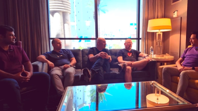
Socket CTO Ahmad Nassri joins AppSec leaders at Black Hat to discuss active malware, package manager risks, and software supply chain defense.
Research
/Security News
Thirteen malicious Packagist themes expose visitors on unpatched iPhones to a WebKit-to-kernel exploit chain that steals device data and wallet seeds.