isochrone-mcp
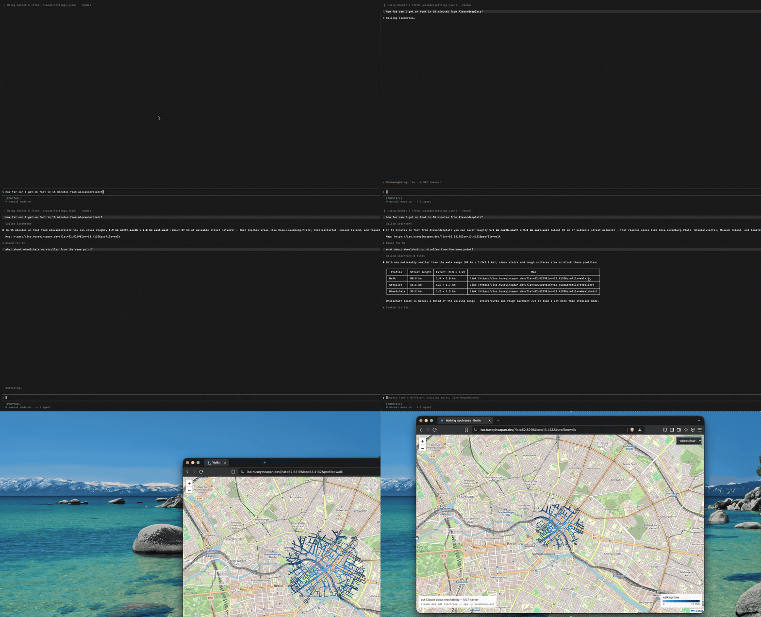
MCP server for pedestrian isochrones: from a point, the actual street network
reachable within a time budget — not a convex hull — for walk, stroller,
wheelchair and bike profiles (stairs and rough surfaces slow or block
strollers and wheelchairs; cycle paths are bike-only).
Backed by iso.huseyincapan.dev
(OSM → pgRouting). Berlin is always covered; other areas can be imported on demand.
This is a portfolio project. The API it calls is a single small VPS with a
60 req/min rate limit — fine for interactive agent use, not for batch jobs.
Install
claude mcp add isochrone -- npx -y isochrone-mcp
Or in any MCP client config:
{ "mcpServers": { "isochrone": { "command": "npx", "args": ["-y", "isochrone-mcp"] } } }
Tool: reachable_area — how far can I get?
lat, lon | required | origin (WGS84) |
minutes | optional | time budget. Faster profiles allow fewer minutes (walk 25, bike 10) because the work grows with the area searched. Omit for the profile's default. |
profile | walk | stroller | wheelchair | bike | mobility profile |
target | optional {lat, lon} | is this destination reachable, and when? |
include_places | default true | also count what's reachable by group |
include_geometry | default false | also return the raw GeoJSON bands |
Returns a prose summary: total street length reached, N–S/E–W extent, arrival
band for the target if given, and a link to view the isochrone on the map.
15 min (walk) from 52.52, 13.405 reaches 132.3 km of streets, spanning
3.0 km N–S × 3.5 km E–W in 10 arrival-time bands.
Target 52.522, 13.41 is reachable: arrival ~7.5–9.0 min (band 6 of 10).
Places within reach: 414 food, 284 shops, 200 culture, 166 outdoors, 51 money.
Map: https://iso.huseyincapan.dev/?lat=52.52&lon=13.405&profile=walk
Tool: places_nearby — what can I get to?
Lists actual places with how long each takes to reach. Called without group
or kinds it returns a breakdown by group and invites you to pick one, rather
than an arbitrary mixture of the nearest things.
lat, lon | required | origin (WGS84) |
minutes, profile | optional | as above |
group | optional | food, shops, culture, health, learning, outdoors, money |
kinds | optional | specific kinds, e.g. ["cafe","bakery"]; wins over group |
limit | default 15 | how many to list, nearest first |
8 pharmacy places within 15 min (walk) of 52.5219, 13.4132; nearest 3:
· 3.1 min — Bezirksapotheke am Roten Rathaus (pharmacy)
· 3.8 min — Panorama Apotheke (pharmacy)
· 5.8 min — Alexa Apotheke (pharmacy)
Point it at your own deployment with ISOCHRONE_API=https://your-host.
Caveats
- Berlin is always covered. Elsewhere depends on whether somebody has
imported that area on the map yet; if not, you get an "outside coverage"
error naming the nearest coverage, and anyone can add a 5×5 km area from
the map in under a minute.
- The bike profile ignores one-way restrictions: the data doesn't record
where contraflow cycling is allowed, and in Berlin it usually is.
- Stroller/wheelchair speed factors are reasoned estimates, not calibrated
measurements.