

Product
PHP and Composer Support Is Now in Beta
Socket’s PHP and Composer support is now in Beta for all customers, with PHP reachability analysis generally available.
By Trevor Norris, Benjamin Barslev - Aug 21, 2026
umbra-py
Advanced tools
A Python-first toolkit to make Umbra SAR open data easy to discover, load, download, and analyze.




A Python toolkit to discover, preview, load, and analyze Umbra open SAR data.
Umbra publishes 16–25 cm synthetic aperture radar as CC BY 4.0 open data, but
there is no search API — only a 17+ TB S3 bucket and a static STAC tree.
umbra-py is the missing layer: search, preview, download, and analysis-ready
arrays without writing the same 500 lines of glue first.
📖 Docs: umbra-py.space · Showcase: browse the archive in the browser (no install)
Status: v0.1.1. Discovery, download, xarray loading, SICD → geocoded COG, change/timescan composites, chips, a local STAC API, and an MCP server all ship. This is not an InSAR toolbox (phase is not preserved through convert). Not affiliated with Umbra Lab, Inc.
pip install umbra-py              # core: search + download + metadata
pip install "umbra-py[load]"      # + xarray / rasterio
pip install "umbra-py[viz]"       # + quicklooks, maps, galleries
pip install "umbra-py[convert]"   # + SICD → geocoded COG
pip install "umbra-py[all]"       # convert + load + viz + export
Python 3.10+. Other extras (dask, serve, mcp, ai, langchain,
llamaindex) are listed in the install guide.
Fetch the weekly catalog snapshot, then search and preview offline. A live
walk of the bucket (umbra search without --local) works but is slow.
pip install "umbra-py[viz,load]"
umbra index fetch
umbra search --local --area Centerfield --product GEC --limit 3
umbra gallery --local --area Centerfield --limit 6 --out gallery.html --db
from umbra_py import CatalogIndex, to_xarray

with CatalogIndex.from_release() as index:
    item = next(iter(index.search(area="Centerfield", product_types=["GEC"], limit=1)))

# Stream a downsampled window over HTTP — no multi-GB download. Needs [load].
da = to_xarray(item, max_size=1024, db=True)
print(item.summary())
If the snapshot is missing, the same search against the live bucket is
UmbraCatalog().search(...) / umbra search --area Centerfield.
More detail, options, and caveats live in the docs.
Search by bbox, place name, polygon, or Umbra task (area=).
--local reads the snapshot; omit it to walk S3.
from umbra_py import UmbraCatalog

for item in UmbraCatalog().search(area="Centerfield", product_types=["GEC"], limit=5):
    print(item.summary())
Preview without downloading the scene: umbra gallery, umbra quicklook <stac-url> --out scene.png --db, umbra view <stac-url> (full-res tiles),
or umbra change --area Centerfield --out change.png.
Load a geocoded GEC into xarray or a GeoTIFF (to_xarray, to_geotiff,
to_stack). Needs [load].
Convert a SICD to a north-up COG (sicd_to_geocoded_cog, umbra convert).
Needs [convert]. Open products generally have no radiometric metadata, so
--calibrate / --noise-model measured refuse rather than invent numbers.
See limitations.
Chip scenes into georeferenced ML tiles: umbra chips --area Centerfield --out chips/.
Drive it from an agent. Zero-install MCP server:
uvx --from 'umbra-py[mcp]' umbra-mcp
{
  "mcpServers": {
    "umbra": {
      "command": "uvx",
      "args": ["--from", "umbra-py[mcp]", "umbra-mcp"]
    }
  }
}
That command is published to the MCP registry
as io.github.reesehammer/umbra-mcp. A local STAC API is umbra serve (needs
[serve]); docker compose up is the one-command form. There is no public
hosted instance yet.
| Asset | What it is | Use it for |
|---|---|---|
GEC | Geocoded cloud-optimized GeoTIFF | Map-ready imagery. Start here. |
CSI | Color sub-aperture GeoTIFF | Quick-look RGB, not a measurement |
SIDD | Geocoded detected image (NITF) | Detected imagery in a standard format |
SICD | Complex data in the radar slant plane (NITF) | Phase-preserving work, InSAR inputs |
CPHD | Compensated phase history | Custom image formation |
umbra-py downloads SICD/CPHD and can geocode a SICD to amplitude. It does
not form interferograms or compute coherence.
Umbra's imagery is CC BY 4.0. If you use or redistribute the data or derived products you must attribute Umbra, e.g.:
Contains Umbra open data, licensed under CC BY 4.0.
umbra-py itself is Apache 2.0 (LICENSE). The two licenses
are independent and compatible.
Machine-readable metadata lives in CITATION.cff. GitHub renders it as a "Cite this repository" button. Please also honor the CC BY 4.0 line above for any Umbra data you use.
Built on the SAR open-source community, including
sarpy and Umbra's open data program.
Not affiliated with or endorsed by Umbra Lab, Inc.
FAQs
A Python-first toolkit to make Umbra SAR open data easy to discover, load, download, and analyze.
We found that umbra-py demonstrated a healthy version release cadence and project activity because the last version was released less than a year ago. It has 1 open source maintainer collaborating on the project.
Product
Socket’s PHP and Composer support is now in Beta for all customers, with PHP reachability analysis generally available.
Product
Socket is bringing experimental protection to Firefox, scanning 97,000+ extensions in Mozilla's official directory for malware and risky updates.
Research
/Security News
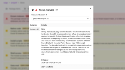
Three compromised Rust crates pulled in a malicious dependency that downloaded and executed cross-platform malware during Cargo builds.