
Security News
Next.js moves to scheduled security releases
Vercel is formalizing a monthly release program for Next.js. The change follows React2Shell and a sharp rise in AI-assisted vulnerability discovery.
By Sarah Gooding - Jul 16, 2026
@zwaarcontrast/ol-graticule-projected
Advanced tools
Generic proj4-backed grid system for ol-graticule. Works with any CRS.
Generic proj4-backed GridSystem for @zwaarcontrast/ol-graticule.
Use it to render a graticule in any CRS, UTM zones, state planes, national
grids, on top of any OL view projection.

Live demo: https://zwaarcontrast.nl/ol-graticule/ol-graticule-projected/
npm install @zwaarcontrast/ol-graticule @zwaarcontrast/ol-graticule-projected ol proj4
Peers: ol ^10, proj4 ^2.9, @zwaarcontrast/ol-graticule.
import { UniversalGraticule } from '@zwaarcontrast/ol-graticule';
import { ProjectedGridSystem } from '@zwaarcontrast/ol-graticule-projected';

const gridSystem = new ProjectedGridSystem({
  crs: 'EPSG:32633',
  proj4Def: '+proj=utm +zone=33 +datum=WGS84 +units=m +no_defs',
});

map.addLayer(new UniversalGraticule({ gridSystem, style: { edgeLabel: true } }));
MetricIntervals + MetricFormatter are auto-selected because the CRS uses
metres, so labels read "500 km", "20 km", etc.
const gridSystem = new ProjectedGridSystem({
  crs: 'EPSG:2227',
  proj4Def:
    '+proj=lcc +lat_1=38.43333333333333 +lat_2=37.06666666666667 +lat_0=36.5 ' +
    '+lon_0=-120.5 +x_0=2000000.0001016 +y_0=500000.0001016001 +datum=NAD83 ' +
    '+units=us-ft +no_defs',
  // Optional: clip to the valid AoU so lines don't wander off.
  extent: [5905300, 1477700, 7540700, 2396900],
});
If several parts of your app talk to the same CRS, register it once at app
startup and omit proj4Def from the grid-system options:
import { registerCRS } from '@zwaarcontrast/ol-graticule-projected';

registerCRS('EPSG:32633', '+proj=utm +zone=33 +datum=WGS84 +units=m +no_defs');

// Later, no proj4Def needed, the CRS is already in proj4/OL's registry.
new ProjectedGridSystem({ crs: 'EPSG:32633' });
registerCRS is idempotent; passing proj4Def to the constructor is a
convenience shortcut that calls it for you.
| Option | Type | Default | What it does |
|---|---|---|---|
crs | string | , (required) | EPSG code or other proj4-known name. |
proj4Def | string | , | proj4 definition. Registered via registerCRS if provided. Omit if already registered. |
extent | [minX, minY, maxX, maxY] | projection's built-in extent | Axis-aligned validity bounds in CRS coordinates. Lines outside are clipped. |
clipPolygon | [x, y][] | , | Irregular boundary polygon in CRS coordinates (for non-rectangular coverage). Overrides extent for drawing. |
intervals | IntervalStrategy | auto from CRS units | Spacing strategy. Degrees → DegreeIntervals, metres → MetricIntervals. |
formatter | LabelFormatter | auto from CRS units | Label formatter. Degrees → DegreeFormatter, metres → MetricFormatter. |
targetScreenPx | number | 100 | Desired minimum spacing (px) between major lines. Drives interval selection. |
densificationPoints | number | 100 | Points per grid line for curved rendering across projections. Higher = smoother, slower. |
ProjectedGridSystem.parseCoordinate takes a label and returns view-projection
coords:
import { ParseError } from '@zwaarcontrast/ol-graticule';

try {
  const center = gridSystem.parseCoordinate('500000 5000000', map.getView().getProjection());
  map.getView().animate({ center });
} catch (err) {
  if (err instanceof ParseError) console.warn(err.reason);
}
For per-axis CRSs (the common case) it splits on whitespace or comma and
parses each half via the formatter ("500000 5000000", "500000, 5000000",
"500000 m 5000000 m"). For degree-units CRSs, hemisphere markers route the
two halves to lat/lon automatically; without markers, plain "x y" is
treated as "lon lat". Compound formatters (e.g. MBSFormatter from
ol-graticule-modified-british-system) plug in via formatter.parseCoordinate
so you can type "vK 617 517" directly and the system transforms the result
to your view projection.
extent vs clipPolygonextent when the CRS has a rectangular validity region (UTM zones,
state planes with square AoUs). Cheaper and sufficient most of the time.clipPolygon when the coverage is irregularly shaped, e.g. the
Netherlands outline for RD, the Nord de Guerre WWI coverage polygon. Lines
are clipped to the polygon and cells outside it don't draw.Both can coexist, the grid system intersects them.
If your CRS needs a sub-metre NTv2 datum shift (e.g. +nadgrids=@mygrid),
register the grid file with proj4 once before constructing the system:
import { loadNadgrid } from '@zwaarcontrast/ol-graticule-projected';

await loadNadgrid('@mygrid', '/assets/mygrid.gsb');

new ProjectedGridSystem({
  crs: 'EPSG:1234',
  proj4Def: '+proj=… +nadgrids=@mygrid +…',
});
For Dutch RD (EPSG:28992/28991) with RDNAPTRANS 2018 pre-bundled, use
@zwaarcontrast/ol-graticule-rd instead of wiring this
up yourself.
ProjectedGridSystem, ProjectedGridSystemOptionsregisterCRS(code, proj4Def), idempotent proj4 + OL registration.loadNadgrid(name, url), fetch + register an NTv2 .gsb file.MetricIntervals, MetricFormatter, re-exported from core for convenience.MIT.
FAQs
Generic proj4-backed grid system for ol-graticule. Works with any CRS.
We found that @zwaarcontrast/ol-graticule-projected demonstrated a healthy version release cadence and project activity because the last version was released less than a year ago. It has 1 open source maintainer collaborating on the project.
Did you know?

Socket for GitHub automatically highlights issues in each pull request and monitors the health of all your open source dependencies. Discover the contents of your packages and block harmful activity before you install or update your dependencies.
Security News
Vercel is formalizing a monthly release program for Next.js. The change follows React2Shell and a sharp rise in AI-assisted vulnerability discovery.

Research
/Security News
11 malicious NuGet tools pose as game cheats to deploy Windows payloads, track hosts, and use Google Sheets for telemetry and control.
Research
/Security News
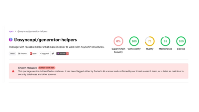
4 compromised asyncapi packages deliver miasma botnet loader on macOS, Linux and Windows.