Mapboxed
Generate assembled mapbox tilesets.
CLI Usage
Usage: mapboxed [options]
Downloads tiles from mapbox and stitches them together into one image file
Options:
-V, --version output the version number
-z, --zoom <zoom> zoom level
-l, --location <location> string query specifying the location of interest
-x1 <x1> left longitude boundary
-x2 <x2> right longitude boundary
-y1 <y1> top latitude boundary
-y2 <y2> bottom latitude boundary
-o, --outfile <outfile> output filename (default: "mapboxed.jpg")
-t, --tileset <tileset> mapbox tileset id (default: "mapbox.satellite")
-k, --key <token> mapbox token (will override read from MAPBOX_TOKEN
environment variable)
-f, --format <format> image format to download (jpg90 | jpg80 | jpg70 |
png256 | png128 | png64 | png32 | png) (default: "jpg90")
-p, --parallel <parallel> Number of parallel connection to make to mapbox (default: "5")
-r, --res2x fetch @2x size resolution
-s, --silent do not confirm download size
-c, --cache keep and read from temp tile files in .mapboxed
-h, --help display help for command
The output file stitches together the tiles specified by the parameters given. Note that if the coordinate boundaries specified in the arguments do not fall precisely on a tile boundary, mapboxed will output a file up to the nearest tile still containing your entire coordinate boundaries. This final boundary is written to the image's metadata in the description field as a serialized array in the form of [lng1, lat1, lng2, lat2].
Examples
with npm version 5.2.0 or up, directly run the following commands in the terminal, no extra installation necessary. (Note: you will need a mapbox access token to be set with the environment variable MAPBOX_TOKEN or passed in with -k)
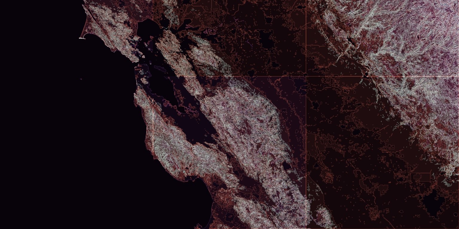
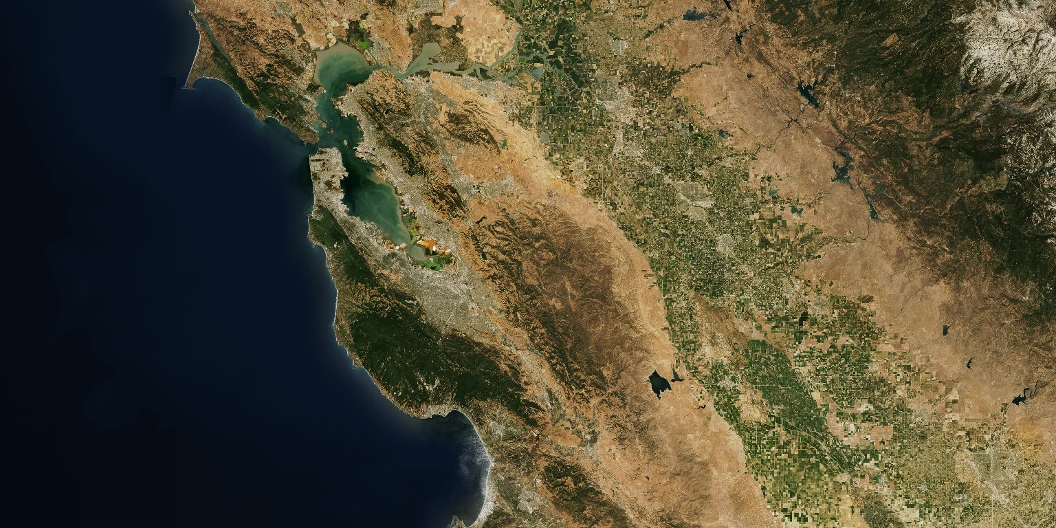
npx mapboxed -z 9 -x1 -123.0652 -y1 38.1799 -x2 -120.1163 -y2 37.1431
npx mapboxed -z 9 -x1 -123.0652 -y1 38.1799 -x2 -120.1163 -y2 37.1431 -t mapbox.mapbox-terrain-v2