Security News
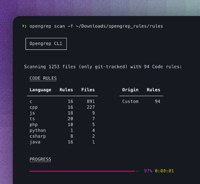
Opengrep Emerges as Open Source Alternative Amid Semgrep Licensing Controversy
Opengrep forks Semgrep to preserve open source SAST in response to controversial licensing changes.
@giscience/ohsome2x
Advanced tools
Query OSM History Data (count, length, area) about specific OSM Features or OSM User activity (user-count) for your areas of interest.
Input: Accepts GeoJSON or PostgreSQL/PostGIS as input source.
Output: Creates a GeoJSON File or new result table in your PostgreSQL/PostGIS database.
The package includes a library with a single class to run.
Additionally it includes ohsome2x-cli, a command-line tool with a configuration wizard to create and run a query-configuration-JSON.
This library/tool makes use of the ohsome API (https://api.ohsome.org) as data backend and many other great open-source libraries.
Currently supported ohsome API query types are:
//standard
elements/count/groupBy/boundary
elements/length/groupBy/boundary
elements/area/groupBy/boundary
elements/perimeter/groupBy/boundary

//ratio
elements/count/ratio/groupBy/boundary
elements/length/ratio/groupBy/boundary
elements/area/ratio/groupBy/boundary
elements/perimeter/ratio/groupBy/boundary

//group by tags within each boundary
elements/count/groupBy/boundary/groupBy/tag
elements/length/groupBy/boundary/groupBy/tag
elements/area/groupBy/boundary/groupBy/tag
elements/perimeter/groupBy/boundary/groupBy/tag

//contributors
users/count/groupBy/boundary
This software is developed by HeiGIT:

There are two ways how you can use ohsome2x.
npxInfo: The
npxcommand comes with the installation ofnpm.
To run the command-line wizard:
Syntax info:
$ npx @giscience/ohsome2x
-------------------------
USAGE:
with 'npx'
npx @giscience/ohsome2x createconfig [(-o|--out) path]
npx @giscience/ohsome2x run (-c|--conf) fullConfig.json
as local command
node ohsome2x-cli.js createconfig [(-o|--out) path]
node ohsome2x-cli.js run (-c|--conf) fullConfig.json
-------------------------
For use as library in Node.js install the package:
$ npm install @giscience/ohsome2x
You find the built library in the /dist folder after executing:
$ npm run build
Write your own JavaScript or TypeScript file:
See Examples and API section to learn how to do it. Enjoy!
{
  "type": "FeatureCollection",
  "features": [
    {
      "type": "Feature",
      "properties": {"id": "Heidelberg"},
      "geometry": {
        "type": "Polygon",
        "coordinates": [
          [ [8.625984191894531, 49.38527827629032],
            [8.735504150390625, 49.38527827629032],
            [8.735504150390625, 49.433975502014675],
            [8.625984191894531, 49.433975502014675],
            [8.625984191894531, 49.38527827629032]
          ]]}}]}
Info: for the filter Syntax see: https://docs.ohsome.org/ohsome-api/stable/filter.html
{
  "ohsomeQuery": {
    "queryType": "elements/count/groupBy/boundary",
    "filter": "building=* and building!=no and geometry:polygon",
    "time": "2008/2020/P1Y"
  },
  "source": {
    "geometryId": "id",
    "name": "heidelberg.geojson",
    "store": { "path": "heidelberg.geojson", "type": "geojson" }
  },
  "target": {
    "horizontalTimestampColumns": false,
    "createGeometry": true,
    "transformToWebmercator": false,
    "storeZeroValues": true,
    "computeValuePerArea": true,
    "name": "heidelberg_buildings_count.geojson",
    "store": { "path": "heidelberg_buildings_count.geojson", "type": "geojson" }
  }
}
$ npx @giscience/ohsome2x run --conf myquery.json
Node:
const Ohsome2X = require('@giscience/ohsome2x');

// you can create this config using the command-line wizard, run: npx ohsome2x-cli
const config = {
                ohsomeQuery: {...},
                source: {...},
                target: {...}
}

const ohsome2x = new Ohsome2X(config);

// This will return a Promise
ohsome2x.run().catch(console.log);
TypeScript:
import Ohsome2X = require('@giscience/ohsome2x');
import {Ohsome2XConfig} from '@giscience/ohsome2x/dist/config_types_interfaces';

// you can create this config using the command-line wizard, run: npx ohsome2x-cli
const config: Ohsome2XConfig = {
                ohsomeQuery: {...},
                source: {...},
                target: {...}
}

const ohsome2x = new Ohsome2X(config);

// This will return a Promise
ohsome2x.run().catch(console.log);
The Ohsome2X object currently provides 2 event types that can be listened to:
progress for getting progress updates. Especially useful for iterative processing of large input datasets
progress provides the following object to your callback (use processed and total to compute a progress percentage):
{
    "type":      "progress",
    "processed": <number> of already finished input geometries,
    "total":     <number> of all input geometries,
    "cursor":    <number> that indicates the current state of iterative processing in case you configured source and target as PostGIS-Stores and specified a fetchSize,
    "fetchSize": <number> fetchSize that is currently used to fetch the next chunk of source data,
    "timestamp": <string> ISO timestamp
}
finished to get some information on duration and finishing time:
{
    "type":         "finished",
    "duration":     <string> a human readable duration like '2 days 13 hours 45 min 12 seconds',
    "duration_ms":  <number> duration in milliseconds,
    "timestamp":    <string> ISO timestamp
}
Example:
const Ohsome2X = require('@giscience/ohsome2x');

// you can create this config using the command-line wizard, run: npx ohsome2x-cli
const config = {
              ohsomeQuery: {
                  "queryType": "users/count/groupBy/boundary",
                  "filter": "natural=tree and type:node",
                  "time": "2010/2020/P1Y"
              },
              source: {
                   "schema": "public",
                   "name": "my_source_table_name",
                   "geometryId": "id", // name of the id column. Can be numbers or strings.
                   "geometryColumn": "geom",
                   "fetchSize": 5000, // this option triggers an iterative processing
                   "cursor": null, // can be used to resume an interrupted iterative processing at a certain position. Get this information from the 'fetch' event.
                   "store": {
                       "host": "your.postgis.server.com",
                       "port": "5434",
                       "database": "your_database_name",
                       "user": "username",
                       "password": "secret",
                       "type": "postgis"
                   }
              },
              target: {...another PostGIS target config...}
}

const ohsome2x = new Ohsome2X(config);

// define functions to be executed when an event is reported
ohsome2x.on('progress', (evt)=>console.log(evt, ((evt.processed / evt.total) * 100).toFixed(0) +'%'));
ohsome2x.on('finished', (evt)=>console.log(evt.duration));

// This will return a Promise
ohsome2x.run().catch(console.log);
FAQs
convenience library to query ohsome-api using nodejs
The npm package @giscience/ohsome2x receives a total of 9 weekly downloads. As such, @giscience/ohsome2x popularity was classified as not popular.
We found that @giscience/ohsome2x demonstrated a not healthy version release cadence and project activity because the last version was released a year ago. It has 2 open source maintainers collaborating on the project.
Did you know?

Socket for GitHub automatically highlights issues in each pull request and monitors the health of all your open source dependencies. Discover the contents of your packages and block harmful activity before you install or update your dependencies.

Security News
Opengrep forks Semgrep to preserve open source SAST in response to controversial licensing changes.

Security News
Critics call the Node.js EOL CVE a misuse of the system, sparking debate over CVE standards and the growing noise in vulnerability databases.

Security News
cURL and Go security teams are publicly rejecting CVSS as flawed for assessing vulnerabilities and are calling for more accurate, context-aware approaches.