Security News
The Risks of Misguided Research in Supply Chain Security
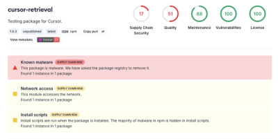
Snyk's use of malicious npm packages for research raises ethical concerns, highlighting risks in public deployment, data exfiltration, and unauthorized testing.
react-map-gl-geocoder
Advanced tools
React wrapper for mapbox-gl-geocoder for use with react-map-gl.
https://codesandbox.io/s/l7p179qr6m
NPM
$ npm install react-map-gl-geocoder
or
Yarn
$ yarn add react-map-gl-geocoder
Import:
import 'react-map-gl-geocoder/dist/mapbox-gl-geocoder.css'
or
Link tag in header:
<link href='https://api.mapbox.com/mapbox-gl-js/plugins/mapbox-gl-geocoder/v4.2.0/mapbox-gl-geocoder.css' rel='stylesheet' />
Only mapRef and mapboxApiAccessToken are required.
| Name | Type | Default | Description |
|---|---|---|---|
| mapRef | Object | Ref for react-map-gl map component. | |
| containerRef | Object | This can be used to place the geocoder outside of the map. The position prop is ignored if this is passed in. Example: https://codesandbox.io/s/v0m14q5rly | |
| onViewportChange | Function | () => {} | Is passed updated viewport values after executing a query. |
| mapboxApiAccessToken | String | https://www.mapbox.com/ | |
| inputValue | String | Sets the search input value | |
| origin | String | "https://api.mapbox.com" | Use to set a custom API origin. |
| zoom | Number | 16 | On geocoded result what zoom level should the map animate to when a bbox isn't found in the response. If a bbox is found the map will fit to the bbox. |
| placeholder | String | "Search" | Override the default placeholder attribute value. |
| proximity | Object | A proximity argument: this is a geographical point given as an object with latitude and longitude properties. Search results closer to this point will be given higher priority. | |
| trackProximity | Boolean | false | If true, the geocoder proximity will automatically update based on the map view. |
| collapsed | Boolean | false | If true, the geocoder control will collapse until hovered or in focus. |
| clearAndBlurOnEsc | Boolean | false | If true, the geocoder control will clear it's contents and blur when user presses the escape key. |
| clearOnBlur | Boolean | false | If true, the geocoder control will clear its value when the input blurs. |
| bbox | Array | A bounding box argument: this is a bounding box given as an array in the format [minX, minY, maxX, maxY]. Search results will be limited to the bounding box. | |
| types | String | A comma seperated list of types that filter results to match those specified. See https://www.mapbox.com/developers/api/geocoding/#filter-type for available types. | |
| countries | String | A comma separated list of country codes to limit results to specified country or countries. | |
| minLength | Number | 2 | Minimum number of characters to enter before results are shown. |
| limit | Number | 5 | Maximum number of results to show. |
| language | String | Specify the language to use for response text and query result weighting. Options are IETF language tags comprised of a mandatory ISO 639-1 language code and optionally one or more IETF subtags for country or script. More than one value can also be specified, separated by commas. | |
| filter | Function | A function which accepts a Feature in the Carmen GeoJSON format to filter out results from the Geocoding API response before they are included in the suggestions list. Return true to keep the item, false otherwise. | |
| localGeocoder | Function | A function accepting the query string which performs local geocoding to supplement results from the Mapbox Geocoding API. Expected to return an Array of GeoJSON Features in the Carmen GeoJSON format. | |
| reverseGeocode | Boolean | false | Enable reverse geocoding. Defaults to false. Expects coordinates to be lat, lon. |
| enableEventLogging | Boolean | true | Allow Mapbox to collect anonymous usage statistics from the plugin. |
| render | Function | A function that specifies how the results should be rendered in the dropdown menu. Accepts a single Carmen GeoJSON object as input and return a string. Any html in the returned string will be rendered. Uses mapbox-gl-geocoder's default rendering if no function provided. | |
| position | String | "top-right" | Position on the map to which the geocoder control will be added. Valid values are "top-left", "top-right", "bottom-left", and "bottom-right". |
| onInit | Function | () => {} | Is passed Mapbox geocoder instance as param and is executed after Mapbox geocoder is initialized. |
| onClear | Function | () => {} | Executed when the input is cleared. |
| onLoading | Function | () => {} | Is passed { query } as a param and is executed when the geocoder is looking up a query. |
| onResults | Function | () => {} | Is passed { results } as a param and is executed when the geocoder returns a response. |
| onResult | Function | () => {} | Is passed { result } as a param and is executed when the geocoder input is set. |
| onError | Function | () => {} | Is passed { error } as a param and is executed when an error occurs with the geocoder. |
import 'mapbox-gl/dist/mapbox-gl.css'
import 'react-map-gl-geocoder/dist/mapbox-gl-geocoder.css'
import React, { Component } from 'react'
import MapGL from 'react-map-gl'
import Geocoder from 'react-map-gl-geocoder'

function getAccessToken() {
  var accessToken = null;

  if (typeof window !== 'undefined' && window.location) {
    var match = window.location.search.match(/access_token=([^&\/]*)/);
    accessToken = match && match[1];
  }

  if (!accessToken && typeof process !== 'undefined') {
    // Note: This depends on bundler plugins (e.g. webpack) inmporting environment correctly
    accessToken = accessToken || process.env.MapboxAccessToken; // eslint-disable-line
  }

  return accessToken || null;
}

// Ways to set Mapbox token: https://uber.github.io/react-map-gl/#/Documentation/getting-started/about-mapbox-tokens
const MAPBOX_TOKEN = getAccessToken()

class Example extends Component {
  state = {
    viewport: {
      latitude: 37.7577,
      longitude: -122.4376,
      zoom: 8
    }
  }

  mapRef = React.createRef()

  handleViewportChange = (viewport) => {
    this.setState({
      viewport: { ...this.state.viewport, ...viewport }
    })
  }

  // if you are happy with Geocoder default settings, you can just use handleViewportChange directly
  handleGeocoderViewportChange = (viewport) => {
    const geocoderDefaultOverrides = { transitionDuration: 1000 }

    return this.handleViewportChange({
      ...viewport,
      ...geocoderDefaultOverrides
    })
  }

  render() {
    return (
      <MapGL
        ref={this.mapRef}
        {...this.state.viewport}
        width="100%"
        height="100%"
        onViewportChange={this.handleViewportChange}
        mapboxApiAccessToken={MAPBOX_TOKEN}>
        <Geocoder
          mapRef={this.mapRef}
          onViewportChange={this.handleGeocoderViewportChange}
          mapboxApiAccessToken={MAPBOX_TOKEN}
        />
      </MapGL>
    )
  }
}

export default Example

FAQs
React wrapper for mapbox-gl-geocoder for use with react-map-gl
We found that react-map-gl-geocoder demonstrated a not healthy version release cadence and project activity because the last version was released a year ago. It has 1 open source maintainer collaborating on the project.
Did you know?

Socket for GitHub automatically highlights issues in each pull request and monitors the health of all your open source dependencies. Discover the contents of your packages and block harmful activity before you install or update your dependencies.

Security News
Snyk's use of malicious npm packages for research raises ethical concerns, highlighting risks in public deployment, data exfiltration, and unauthorized testing.

Research
Security News
Socket researchers found several malicious npm packages typosquatting Chalk and Chokidar, targeting Node.js developers with kill switches and data theft.

Security News
pnpm 10 blocks lifecycle scripts by default to improve security, addressing supply chain attack risks but sparking debate over compatibility and workflow changes.