Security News
Research
Data Theft Repackaged: A Case Study in Malicious Wrapper Packages on npm
The Socket Research Team breaks down a malicious wrapper package that uses obfuscation to harvest credentials and exfiltrate sensitive data.
FloPy includes support for MODFLOW 6, MODFLOW-2005, MODFLOW-NWT, MODFLOW-USG, and MODFLOW-2000. Other supported MODFLOW-based models include MODPATH (version 6 and 7), MT3DMS, MT3D-USGS, and SEAWAT.
For general modeling issues, please consult a modeling forum, such as the MODFLOW Users Group. Other MODFLOW resources are listed in the MODFLOW Resources section.
Documentation is available on Read the Docs and includes information on FloPy; tutorials for using FloPy with MODFLOW 6 and previous versions of MODFLOW, MT3DMS, MT3D-USGS, MODPATH, and ZONEBUDGET; and code documentation.
Bug reports, code contributions, or improvements to the documentation are welcome from the community. Prior to contributing, please read up on our guidelines for contributing and then check out one of our issues in the hotlist: community-help.
Citation for FloPy:
Software/Code citation for FloPy:
Unless otherwise noted, This project is in the public domain in the United States because it contains materials that originally came from the United States Geological Survey, an agency of the United States Department of Interior. For more information, see the official USGS copyright policy at https://www2.usgs.gov/visual-id/credit_usgs.html#copyright
Additionally, we waive copyright and related rights in the work worldwide through the CC0 1.0 Universal public domain dedication.
This is a human-readable summary of the Legal Code (read the full text).
The person who associated a work with this deed has dedicated the work to the public domain by waiving all of his or her rights to the work worldwide under copyright law, including all related and neighboring rights, to the extent allowed by law.
You can copy, modify, distribute and perform the work, even for commercial purposes, all without asking permission.
In no way are the patent or trademark rights of any person affected by CC0, nor are the rights that other persons may have in the work or in how the work is used, such as publicity or privacy rights.
Unless expressly stated otherwise, the person who associated a work with this deed makes no warranties about the work, and disclaims liability for all uses of the work, to the fullest extent permitted by applicable law. When using or citing the work, you should not imply endorsement by the author or the affirmer.
FAQs
FloPy is a Python package to create, run, and post-process MODFLOW-based models
We found that flopy demonstrated a healthy version release cadence and project activity because the last version was released less than a year ago. It has 2 open source maintainers collaborating on the project.
Did you know?

Socket for GitHub automatically highlights issues in each pull request and monitors the health of all your open source dependencies. Discover the contents of your packages and block harmful activity before you install or update your dependencies.

Security News
Research
The Socket Research Team breaks down a malicious wrapper package that uses obfuscation to harvest credentials and exfiltrate sensitive data.

Research
Security News
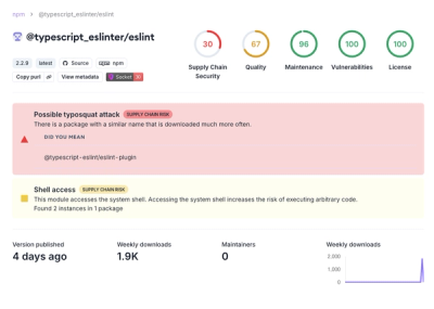
Attackers used a malicious npm package typosquatting a popular ESLint plugin to steal sensitive data, execute commands, and exploit developer systems.

Security News
The Ultralytics' PyPI Package was compromised four times in one weekend through GitHub Actions cache poisoning and failure to rotate previously compromised API tokens.