


MapLapse is a Python-based library to create animated timelapse maps from given shapefiles. It is mainly built on top of geopandas and matplotlib, along with other open-source geospatial packages.
Key Features
- Animated choropleth maps
- Animated proportional circle maps
- Supports output in
.gif and .mp4
Example
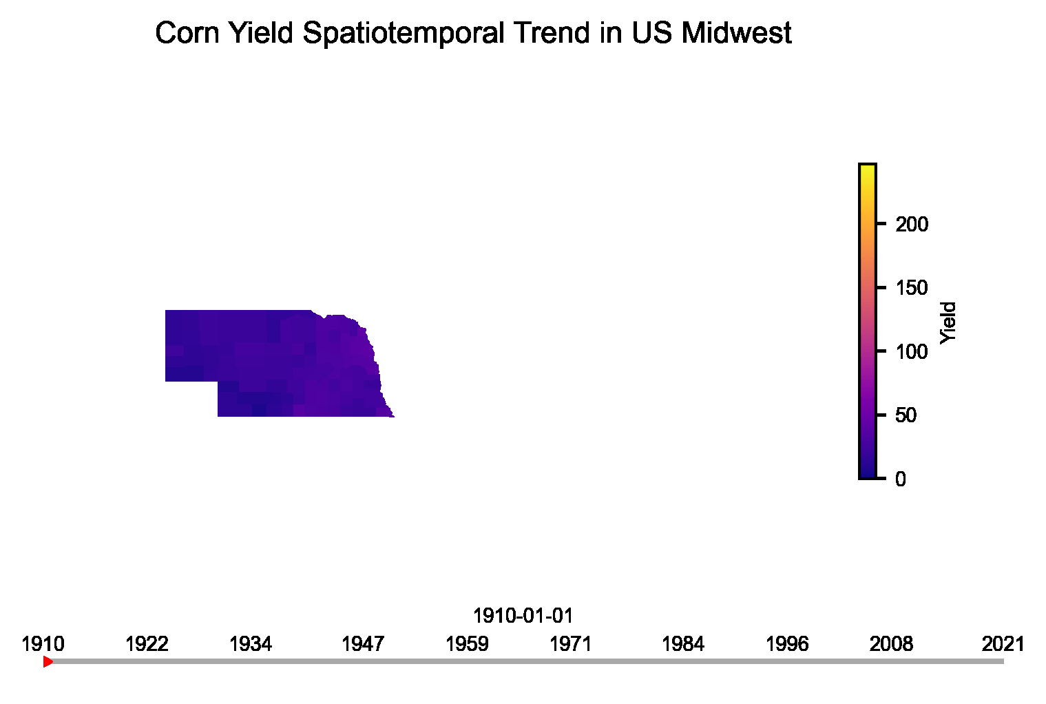
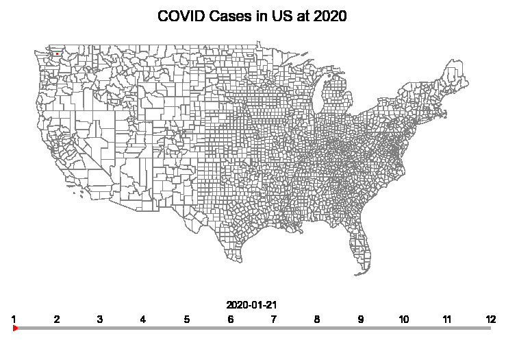
The Animator object of maplapse can easily create the animations. Here is a code snippet:
anim = Animator(shape='/county_shape.shp',
                value='/century_data.csv',
                time_column='Year',
                data_column='Value',
                shape_unique_column='ST_CNT',
                map_type='choropleth',
                out_path='/animation.gif')
anim.animate()
Output:
Installation
Simply use pip install maplapse.
Problems
If you face any issues with the library, please create an issue by following up the steps here


