Security News
PyPI’s New Archival Feature Closes a Major Security Gap
PyPI now allows maintainers to archive projects, improving security and helping users make informed decisions about their dependencies.
Marine Geospatial Ecology Tools: access and manipulate marine ecological and oceanographic data

MGET, also known as the GeoEco Python library, helps researchers access, manipulate, and analyze ecological and oceanographic data. MGET can be accessed through the GeoEco Python API or an associated ArcGIS geoprocessing toolbox.
MGET was developed by the Duke University Marine Geospatial Ecology Lab.
MGET requires 64-bit Python 3.9–3.12 running on Windows or Linux. For full
functionality, ArcGIS Pro 3.2.2 or later or ArcGIS Server 11.2 or later is
also required, along with some freely-available software. MGET can be
installed with pip install mget3, but please see the platform-specific
instructions below to ensure all prerequisites are met.
Ⓘ Note
We are still in the process of porting MGET for Python 2.7 and ArcGIS Desktop to work with Python 3.x and ArcGIS Pro and Server. Not everything has been ported yet. If you have questions about something that is missing, please post a question to the discussion forum.
MGET was originally documented by the following paper. Although much of the underlying software architecture has changed since 2010, the overall concept remains, of using Python to integrate useful code implemented in several languages and to expose it as an ArcGIS geoprocessing toolbox. If you find MGET is useful in your work, please cite this paper in your publication. If you are unable to access the paper, please email jason.roberts@duke.edu for a copy.
Roberts JJ, Best BD, Dunn DC, Treml EA, Halpin PN (2010) Marine Geospatial Ecology Tools: An integrated framework for ecological geoprocessing with ArcGIS, Python, R, MATLAB, and C++. Environmental Modelling & Software 25:1197–1207. doi: 10.1016/j.envsoft.2010.03.029
MGET uses the BSD-3-Clause open source software license. MGET incorporates other open source software. Please see the LICENSE file included with MGET for associated software license statements for these components. We are grateful to these developers for making their work freely reusable.
FAQs
Marine Geospatial Ecology Tools: access and manipulate marine ecological and oceanographic data
We found that mget3 demonstrated a healthy version release cadence and project activity because the last version was released less than a year ago. It has 1 open source maintainer collaborating on the project.
Did you know?

Socket for GitHub automatically highlights issues in each pull request and monitors the health of all your open source dependencies. Discover the contents of your packages and block harmful activity before you install or update your dependencies.

Security News
PyPI now allows maintainers to archive projects, improving security and helping users make informed decisions about their dependencies.

Research
Security News
Malicious npm package postcss-optimizer delivers BeaverTail malware, targeting developer systems; similarities to past campaigns suggest a North Korean connection.

Security News
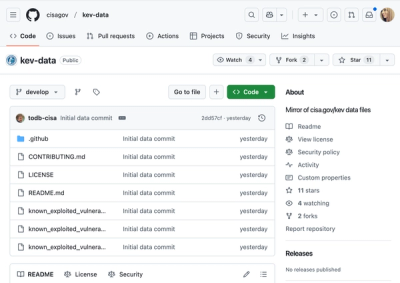
CISA's KEV data is now on GitHub, offering easier access, API integration, commit history tracking, and automated updates for security teams and researchers.