Security News
Research
Data Theft Repackaged: A Case Study in Malicious Wrapper Packages on npm
The Socket Research Team breaks down a malicious wrapper package that uses obfuscation to harvest credentials and exfiltrate sensitive data.
Open-source library to compute landscape metrics in the Python ecosystem (NumPy, pandas, matplotlib...)
Citation: Bosch M. 2019. "PyLandStats: An open-source Pythonic library to compute landscape metrics". PLOS ONE, 14(12), 1-19. doi.org/10.1371/journal.pone.0225734
Read GeoTiff files of land use/cover:
import pylandstats as pls
ls = pls.Landscape("../data/processed/veveyse-AS18_4.tif")
ls.plot_landscape(legend=True)

Compute pandas data frames of landscape metrics at the patch, class and landscape level:
class_metrics_df = ls.compute_class_metrics_df(
    metrics=["proportion_of_landscape", "edge_density", "euclidean_nearest_neighbor_mn"]
)
class_metrics_df
| class_val | proportion_of_landscape | edge_density | euclidean_nearest_neighbor_mn |
|---|---|---|---|
| 1 | 7.749572 | 19.102211 | 309.244705 |
| 2 | 56.271868 | 50.599270 | 229.079970 |
| 3 | 33.946252 | 38.167200 | 253.299859 |
| 4 | 2.032308 | 3.722177 | 552.835154 |
Analyze the spatio-temporal evolution of landscapes:
import matplotlib.pyplot as plt

input_filepaths = [
    "../data/processed/veveyse-AS97R_4.tif",
    "../data/processed/veveyse-AS09R_4.tif",
    "../data/processed/veveyse-AS18_4.tif",
]

sta = pls.SpatioTemporalAnalysis(input_filepaths, dates=["1992", "2004", "2012"])
sta.plot_metric("contagion")

Zonal analysis of landscapes
See the documentation and the pylandstats-notebooks repository for a more complete overview.
The easiest way to install PyLandStats is with conda:
$ conda install -c conda-forge pylandstats
which will install PyLandStats and all of its dependencies. Alternatively, you can install PyLandStats using pip:
$ pip install pylandstats
Nevertheless, note that in order to define zones by vector geometries in ZonalAnalysis, or in order to use the the BufferAnalysis and SpatioTemporalBufferAnalysis classes, PyLandStats requires geopandas, which cannot be installed with pip. If you already have the dependencies for geopandas installed in your system, you might then install PyLandStats with the geo extras as in:
$ pip install pylandstats[geo]
and you will be able to use the aforementioned features (without having to use conda).
To install a development version of PyLandStats, you can first use conda to create an environment with all the dependencies and activate it as in:
$ conda create -n pylandstats -c conda-forge geopandas matplotlib-base rasterio scipy openblas
$ conda activate pylandstats
and then clone the repository and use pip to install it in development mode
$ git clone https://github.com/martibosch/pylandstats.git
$ cd pylandstats/
$ pip install -e .
FAQs
Computing landscape metrics in the Python ecosystem.
We found that pylandstats demonstrated a healthy version release cadence and project activity because the last version was released less than a year ago. It has 1 open source maintainer collaborating on the project.
Did you know?

Socket for GitHub automatically highlights issues in each pull request and monitors the health of all your open source dependencies. Discover the contents of your packages and block harmful activity before you install or update your dependencies.

Security News
Research
The Socket Research Team breaks down a malicious wrapper package that uses obfuscation to harvest credentials and exfiltrate sensitive data.

Research
Security News
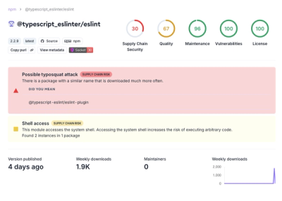
Attackers used a malicious npm package typosquatting a popular ESLint plugin to steal sensitive data, execute commands, and exploit developer systems.

Security News
The Ultralytics' PyPI Package was compromised four times in one weekend through GitHub Actions cache poisoning and failure to rotate previously compromised API tokens.