Security News
Research
Data Theft Repackaged: A Case Study in Malicious Wrapper Packages on npm
The Socket Research Team breaks down a malicious wrapper package that uses obfuscation to harvest credentials and exfiltrate sensitive data.
@radarlabs/s2
Advanced tools
Node.js JavaScript and TypeScript bindings for the Google S2 geolocation library.
Node.js JavaScript & TypeScript bindings for Google S2.
S2 is a library from Google for easily storing, indexing, and retrieving geographic locations.
Geographic regions can be indexed by S2 cell ids of various levels in a data store and then later retrieved by these ids for extremely quick geolocation lookups.
The goal of this library is to maintain Node.js TypeScript bindings for the latest version of Google's C++ S2 library.
Other JavaScript projects available on GitHub appear unmaintained.
The project has been built against Node's N-API, meaning that it's compatible across Node.js versions that support BigInt. This means that Node.js version 9 and below are unsupported.
As of today, the library is built and tested against Node.js 16, 18 and 20. The library has been in production use at Radar and has been built against OS X and Linux. Feel free to open an issue or PR if you'd like other platform support.
See test.sh for more details.
To install:
npm install @radarlabs/s2
To run tests (you'll need Docker):
./test.sh
S2 Cells can be generated from BigInt S2 IDs or string tokens:
const s2 = require('@radarlabs/s2');

const cell1 = new s2.CellId(9926595695177891840n);
console.log(cell1.token());
> 89c25a31

const cell2 = new s2.CellId('89c25a31');
console.log(cell2.id());
> 9926595695177891840n
To generate a covering for a given area:
const s2 = require('@radarlabs/s2');

# an array of lat/lng pairs representing a region (a part of Brooklyn, in this case)
const loopLLs = [[40.70113825399865,-73.99229764938354],[40.70113825399865,-73.98766279220581],[40.70382234072197,-73.98766279220581],[40.70382234072197,-73.99229764938354]];

# map to an array of normalized s2.LatLng
const s2LLs = loopLLs.map(([lat, lng]) => (new s2.LatLng(lat, lng)));

# generate s2 cells to cover this polygon
const s2level = 14;
const covering = s2.RegionCoverer.getCoveringTokens(s2LLs, { min: s2level, max: s2level });
covering.forEach(c => console.log(c));

> 89c25a31
> 89c25a33
> 89c25a35
> 89c25a37

# check if a point is contained inside this region
const point = new s2.CellId(new s2.LatLng(40.70248844447621, -73.98991584777832));
const pointAtLevel14 = point.parent(s2Level);
console.log(pointAtLevel14.token());
> 89c25a31

const coveringSet = new Set(covering);
console.log(coveringSet.contains(pointAtLevel14.token()));
> true
To generate a covering for a given radius around a point:
const s2 = require('@radarlabs/s2');

# make an S2 latlng object for downtown San Diego
const s2LatLong = new s2.LatLng(32.715651, -117.160542);

# set cell covering options so the biggest region is a 6 and smallest is a 13, and limit to 10 cells
const cellCoveringOptions = {min: 6, max: 13, max_cells: 10};

# get the cells (with the size range allowed) covering a 10,000 meter search radius centered on the given location
# Note that this call returns a CellUnion object instead of a list of tokens, which is useful for comparisons
const coveringCells = s2.RegionCoverer.getRadiusCovering(s2LatLong, 10000, cellCoveringOptions);
# For this example though, we'll loop over the cellIds within the CellUnion and get their tokens
console.log(coveringCells.cellIds().map((cellId) => cellId.token()));

> 80d94d
> 80d951
> 80d953
> 80d955
> 80d956c
> 80dbffc
> 80dc01
> 80deab
> 80dead
> 80deb2ac

# the "coveringCells" CellUnion is like the "coveringSet" from the previous example, so can be used directly without converting to a set
# test by checking a cell centered at our lat long
console.log(coveringCells.contains(new s2.CellId(s2LatLong)));
> true
Here's a visualization of the above set of covering cells. The center of the 10k radius is in downtown San Diego.
Check if a cell is contained in another:
const c1 = s2.CellId.fromToken('89c25a37')
const c2 = s2.CellId.fromToken('89c25')
c2.contains(c1)
> true
c1.contains(c2)
> false
If you'd like to see more functionality, feel free to open an issue or create a pull request.
More detailed usage can be found in the tests folder.
The Node S2 is library is at its infancy, so APIs are likely to change. In order to help with versioning, we publish TypeScript bindings so that your compiler can check if anything has changed. To keep up with updates, see CHANGELOG.md
FAQs
Node.js JavaScript and TypeScript bindings for the Google S2 geolocation library.
We found that @radarlabs/s2 demonstrated a not healthy version release cadence and project activity because the last version was released a year ago. It has 7 open source maintainers collaborating on the project.
Did you know?

Socket for GitHub automatically highlights issues in each pull request and monitors the health of all your open source dependencies. Discover the contents of your packages and block harmful activity before you install or update your dependencies.

Security News
Research
The Socket Research Team breaks down a malicious wrapper package that uses obfuscation to harvest credentials and exfiltrate sensitive data.

Research
Security News
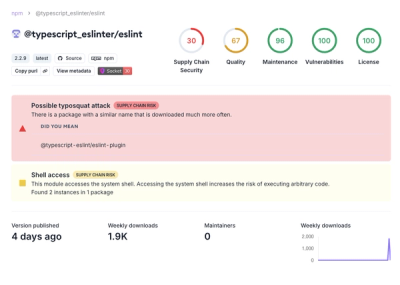
Attackers used a malicious npm package typosquatting a popular ESLint plugin to steal sensitive data, execute commands, and exploit developer systems.

Security News
The Ultralytics' PyPI Package was compromised four times in one weekend through GitHub Actions cache poisoning and failure to rotate previously compromised API tokens.